Gornji Laduč geodata
Gornji Laduč (Zagrebačka) is a populated place; located in Croatia in Europe/Zagreb (GMT+2) time zone. With population of 826 people, there are 580 cities with bigger population in this country. Compared to other cities in Croatia, 76.6% of cities are located further ↓South; 78.8% of cities are located further →East and 56% of cities have lower elevation than Gornji Laduč. Note1


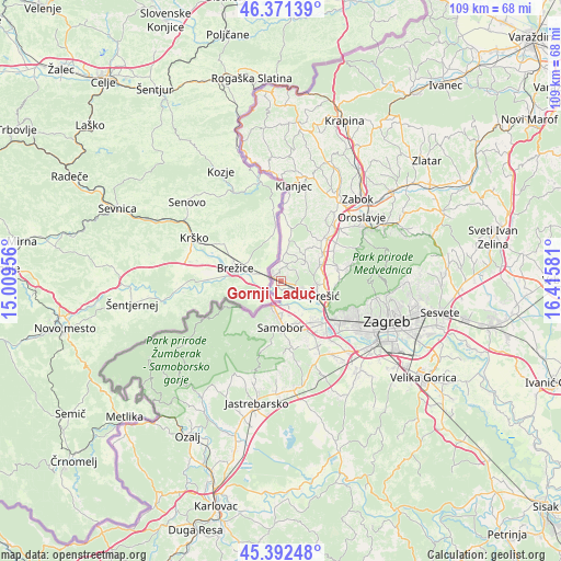
Gornji Laduč GPS coordinates[2]
45° 53' 2.724" North, 15° 42' 45.648" East
| Map corner | latitude | longitude |
|---|---|---|
| Upper-left | 46.37139°, | 15.00956° |
| Center: | 45.88409°, | 15.71268° |
| Lower-right: | 45.39248°, | 16.41581° |
| Map W x H: | 108.8×108.8 km | = 67.6×67.6mi |
| max Lat: | 46.52694° ⇑23.4% North |
| Gornji Laduč: | 45.88409° |
| min Lat: | ⇓76.6% South 42.54972° |
| min Long | Gornji Laduč | max Long |
| 13.52389° | 15.71268° | 19.37694° |
| W 21.2%⇐ | ⇒78.8% E |
Elevation
Elevation of Gornji Laduč is 137 m = 449 ft, and this is 16.3 m = 53 ft below average elevation for this country.
| Max E: |
827 m = 2713 ft | 44% |
| Avg. | 153.3 m = 503 ft | |
| Gornji Laduč | 137 m = 449 ft | |
Min E: |
-1 m = -3 ft | 56% |
See also: Croatia elevation on elevation.city.
Geographical zone
Gornji Laduč is located in North temperate zone (between Tropic of Cancer and the Arctic Circle). Distance of this North polar circle is 2299.3 km =1428.7 mi to North.| Distance of | km | miles | from Gornji Laduč |
|---|---|---|---|
| North Pole | 4905.2 | 3047.9 | to North |
| Arctic Circle | 2299.3 | 1428.7 | to North |
| Tropic Cancer | 2495.9 | 1550.9 | to South |
| Equator | 5101.8 | 3170.1 | to South |


Nearby cities:
15 places around Gornji Laduč: (largest is in red/bold)
• Brdovec
4.9 km =3 mi,  113°
113°
• Bregana
5.3 km =3.3 mi,  201°
201°
• Domaslovec
9 km =5.6 mi,  159°
159°
• Donja Pušća
6.2 km =3.9 mi,  54°
54°
• Donji Laduč
1.6 km =1 mi,  93°
93°
• Dubravica
7.5 km =4.7 mi,  12°
12°
• Gornja Pušća
6.7 km =4.2 mi,  42°
42°
• Javorje
4.8 km =3 mi,  123°
123°
• Ključ Brdovečki
1.6 km =1 mi,  264°
264°
• Kupljenovo
8.8 km =5.5 mi,  55°
55°
• Marija Gorica
3.2 km =2 mi,  21°
21°
• Pojatno
7.2 km =4.5 mi,  71°
71°
• Prigorje Brdovečko
2 km =1.2 mi,  104°
104°
• Zaprešić
8 km =5 mi, 112°
• Zdenci Brdovečki
3.5 km =2.2 mi, 123°
Sources, notices
• [Note1] Compared only with cities in Croatia existing in our database
• [Src1] Map data: © OpenStreetMap contributors (CC-BY-SA)
• [Src2] Other city data from geonames.org with taken over terms of usage.
• [Src3] Geographical zone / Annual Mean Temperature by Robert A. Rohde @ Wikipedia
