Zaprešić geodata
Zaprešić (Zagrebačka) is a seat of a second-order administrative division; located in Croatia in Europe/Zagreb (GMT+2) time zone. With population of 19,664 people, there are 22 cities with bigger population in this country. Compared to other cities in Croatia, 74.8% of cities are located further ↓South; 75.1% of cities are located further →East and 51.2% of cities have lower elevation than Zaprešić. Note1


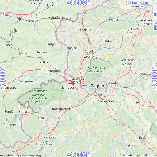
Zaprešić GPS coordinates[2]
45° 51' 23.004" North, 15° 48' 28.008" East
| Map corner | latitude | longitude |
|---|---|---|
| Upper-left | 46.34393°, | 15.10466° |
| Center: | 45.85639°, | 15.80778° |
| Lower-right: | 45.36454°, | 16.51091° |
| Map W x H: | 108.9×108.9 km | = 67.7×67.7mi |
| max Lat: | 46.52694° ⇑25.2% North |
| Zaprešić: | 45.85639° |
| min Lat: | ⇓74.8% South 42.54972° |
| min Long | Zaprešić | max Long |
| 13.52389° | 15.80778° | 19.37694° |
| W 24.9%⇐ | ⇒75.1% E |
Elevation
Elevation of Zaprešić is 129 m = 423 ft, and this is 24.3 m = 80 ft below average elevation for this country.
| Max E: |
827 m = 2713 ft | 48.8% |
| Avg. | 153.3 m = 503 ft | |
| Zaprešić | 129 m = 423 ft | |
Min E: |
-1 m = -3 ft | 51.2% |
See also: Croatia elevation on elevation.city.
Geographical zone
Zaprešić is located in North temperate zone (between Tropic of Cancer and the Arctic Circle). Distance of this North polar circle is 2302.4 km =1430.6 mi to North.| Distance of | km | miles | from Zaprešić |
|---|---|---|---|
| North Pole | 4908.3 | 3049.9 | to North |
| Arctic Circle | 2302.4 | 1430.6 | to North |
| Tropic Cancer | 2492.8 | 1549 | to South |
| Equator | 5098.8 | 3168.2 | to South |


Nearby cities:
15 places around Zaprešić: (largest is in red/bold)
• Bestovje
5.4 km =3.4 mi,  172°
172°
• Brdovec
3.1 km =1.9 mi,  291°
291°
• Domaslovec
6.8 km =4.2 mi,  218°
218°
• Donja Bistra
6.8 km =4.2 mi,  32°
32°
• Donji Laduč
6.5 km =4 mi,  297°
297°
• Ivanec Bistranski
2.1 km =1.3 mi,  119°
119°
• Jablanovec
4.2 km =2.6 mi,  58°
58°
• Javorje
3.4 km =2.1 mi,  277°
277°
• Novaki Bistranski
5.3 km =3.3 mi,  53°
53°
• Orešje
4.5 km =2.8 mi,  185°
185°
• Pojatno
5.4 km =3.4 mi,  354°
354°
• Prigorje Brdovečko
6 km =3.7 mi, 295°
• Rakitje
7 km =4.3 mi, 170°
• Sveta Nedjelja
6.8 km =4.2 mi,  198°
198°
• Zdenci Brdovečki
4.6 km =2.9 mi, 284°
Sources, notices
• [Note1] Compared only with cities in Croatia existing in our database
• [Src1] Map data: © OpenStreetMap contributors (CC-BY-SA)
• [Src2] Other city data from geonames.org with taken over terms of usage.
• [Src3] Geographical zone / Annual Mean Temperature by Robert A. Rohde @ Wikipedia
