Les Irois geodata
Les Irois (GrandʼAnse) is a populated place; located in Haiti in America/Port-au-Prince (GMT-4) time zone. With population of 2,265 people, there are 70 cities with bigger population in this country. Compared to other cities in Haiti, 77.4% of cities are located further ↑North; 100% of cities are located further →East and 71.7% of cities have higher elevation than Les Irois. Note1


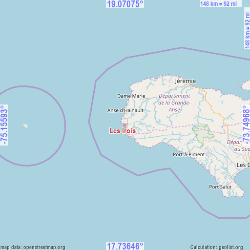
Les Irois GPS coordinates[2]
18° 24' 17.64" North, 74° 27' 10.08" West
| Map corner | latitude | longitude |
|---|---|---|
| Upper-left | 19.07075°, | -75.15593° |
| Center: | 18.4049°, | -74.4528° |
| Lower-right: | 17.73646°, | -73.74968° |
| Map W x H: | 148.4×148.4 km | = 92.2×92.2mi |
| max Lat: | 19.93984° ⇑77.4% North |
| Les Irois: | 18.4049° |
| min Lat: | ⇓22.6% South 18.05° |
| min Long | Les Irois | max Long |
| -74.4528° | -74.4528° | -71.72475° |
| W 0%⇐ | ⇒100% E |
Elevation
Elevation of Les Irois is 14 m = 46 ft, and this is 131.1 m = 430 ft below average elevation for this country.
| Max E: |
1466 m = 4810 ft | 71.7% |
| Avg. | 145.1 m = 476 ft | |
| Les Irois | 14 m = 46 ft | |
Min E: |
3 m = 10 ft | 28.3% |
See also: Haiti elevation on elevation.city.
Geographical zone
Les Irois is located in North Torrid zone (between Equator and Tropic of Cancer). Distance of this Northern Tropic circle is 559.5 km =347.7 mi to North.| Distance of | km | miles | from Les Irois |
|---|---|---|---|
| North Pole | 7960.6 | 4946.5 | to North |
| Arctic Circle | 5354.7 | 3327.3 | to North |
| Tropic Cancer | 559.5 | 347.7 | to North |
| Equator | 2046.4 | 1271.6 | to South |


Nearby cities:
15 places around Les Irois: (largest is in red/bold)
• Camp Perrin
62.4 km =38.8 mi,  98°
98°
• Chambellan
21.9 km =13.6 mi,  42°
42°
• Chantal
63.6 km =39.5 mi,  110°
110°
• Chardonnière
33.5 km =20.8 mi,  115°
115°
• Corail
62.1 km =38.6 mi,  73°
73°
• Dame-Marie
17.7 km =11 mi,  10°
10°
• Jérémie
44.7 km =27.8 mi,  52°
52°
• Koto
48.9 km =30.4 mi, 116°
• Les Abricots
31.1 km =19.3 mi,  29°
29°
• Les Anglais
27 km =16.8 mi, 114°
• Moron
26.9 km =16.7 mi, 49°
• Port-à-Piment
41.3 km =25.7 mi, 114°
• Roche-à-Bateau
53.5 km =33.2 mi, 117°
• Tiburon
10.6 km =6.6 mi,  145°
145°
• Torbeck
73 km =45.4 mi, 111°
Sources, notices
• [Note1] Compared only with cities in Haiti existing in our database
• [Src1] Map data: © OpenStreetMap contributors (CC-BY-SA)
• [Src2] Other city data from geonames.org with taken over terms of usage.
• [Src3] Geographical zone / Annual Mean Temperature by Robert A. Rohde @ Wikipedia
