Chambellan geodata
Chambellan (GrandʼAnse) is a populated place; located in Haiti in America/Port-au-Prince (GMT-4) time zone. With population of 1,397 people, there are 96 cities with bigger population in this country. Compared to other cities in Haiti, 62.3% of cities are located further ↑North; 97.2% of cities are located further →East and 61.3% of cities have lower elevation than Chambellan. Note1


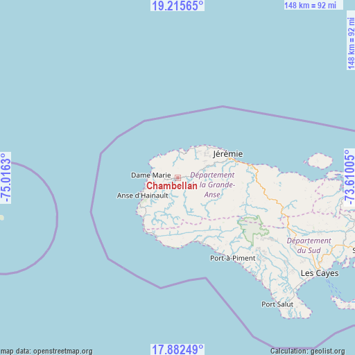
Chambellan GPS coordinates[2]
18° 33' 1.332" North, 74° 18' 47.412" West
| Map corner | latitude | longitude |
|---|---|---|
| Upper-left | 19.21565°, | -75.0163° |
| Center: | 18.55037°, | -74.31317° |
| Lower-right: | 17.88249°, | -73.61005° |
| Map W x H: | 148.2×148.2 km | = 92.1×92.1mi |
| max Lat: | 19.93984° ⇑62.3% North |
| Chambellan: | 18.55037° |
| min Lat: | ⇓37.7% South 18.05° |
| min Long | Chambellan | max Long |
| -74.4528° | -74.31317° | -71.72475° |
| W 2.8%⇐ | ⇒97.2% E |
Elevation
Elevation of Chambellan is 69 m = 226 ft, and this is 76.1 m = 250 ft below average elevation for this country.
| Max E: |
1466 m = 4810 ft | 38.7% |
| Avg. | 145.1 m = 476 ft | |
| Chambellan | 69 m = 226 ft | |
Min E: |
3 m = 10 ft | 61.3% |
See also: Haiti elevation on elevation.city.
Geographical zone
Chambellan is located in North Torrid zone (between Equator and Tropic of Cancer). Distance of this Northern Tropic circle is 543.3 km =337.6 mi to North.| Distance of | km | miles | from Chambellan |
|---|---|---|---|
| North Pole | 7944.5 | 4936.5 | to North |
| Arctic Circle | 5338.6 | 3317.3 | to North |
| Tropic Cancer | 543.3 | 337.6 | to North |
| Equator | 2062.6 | 1281.6 | to South |


Nearby cities:
15 places around Chambellan: (largest is in red/bold)
• Camp Perrin
53.2 km =33.1 mi,  117°
117°
• Chantal
59.2 km =36.8 mi,  130°
130°
• Chardonnière
34.3 km =21.3 mi,  153°
153°
• Corail
44.7 km =27.8 mi,  87°
87°
• Dame-Marie
11.5 km =7.1 mi,  275°
275°
• Jérémie
23.5 km =14.6 mi,  61°
61°
• Koto
47.9 km =29.8 mi,  143°
143°
• Les Abricots
11 km =6.8 mi,  2°
2°
• Les Anglais
29 km =18 mi,  160°
160°
• Les Irois
21.9 km =13.6 mi,  222°
222°
• Moron
5.9 km =3.7 mi,  79°
79°
• Port-à-Piment
40.5 km =25.2 mi, 145°
• Roche-à-Bateau
52.4 km =32.6 mi, 141°
• Tiburon
26.4 km =16.4 mi,  199°
199°
• Torbeck
68.4 km =42.5 mi, 128°
Sources, notices
• [Note1] Compared only with cities in Haiti existing in our database
• [Src1] Map data: © OpenStreetMap contributors (CC-BY-SA)
• [Src2] Other city data from geonames.org with taken over terms of usage.
• [Src3] Geographical zone / Annual Mean Temperature by Robert A. Rohde @ Wikipedia
