Madocsa geodata
Madocsa (Tolna) is a populated place; located in Hungary in Europe/Budapest (GMT+2) time zone. With population of 1,935 people, there are 815 cities with bigger population in this country. Compared to other cities in Hungary, 80.8% of cities are located further ↑North; 66.2% of cities are located further →East and 80.4% of cities have higher elevation than Madocsa. Note1


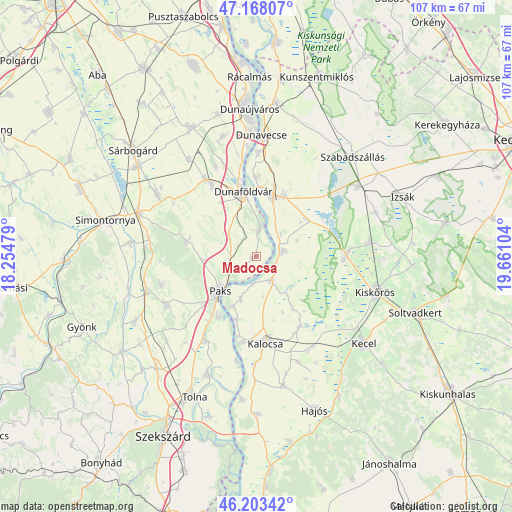
Madocsa GPS coordinates[2]
46° 41' 16.44" North, 18° 57' 28.476" East
| Map corner | latitude | longitude |
|---|---|---|
| Upper-left | 47.16807°, | 18.25479° |
| Center: | 46.6879°, | 18.95791° |
| Lower-right: | 46.20342°, | 19.66104° |
| Map W x H: | 107.3×107.3 km | = 66.7×66.7mi |
| max Lat: | 48.46667° ⇑80.8% North |
| Madocsa: | 46.6879° |
| min Lat: | ⇓19.2% South 45.79108° |
| min Long | Madocsa | max Long |
| 16.27358° | 18.95791° | 22.68096° |
| W 33.8%⇐ | ⇒66.2% E |
Elevation
Elevation of Madocsa is 95 m = 312 ft, and this is 34.7 m = 114 ft below average elevation for this country.
| Max E: |
444 m = 1457 ft | 80.4% |
| Avg. | 129.7 m = 426 ft | |
| Madocsa | 95 m = 312 ft | |
Min E: |
71 m = 233 ft | 19.6% |
See also: Hungary elevation on elevation.city.
Geographical zone
Madocsa is located in North temperate zone (between Tropic of Cancer and the Arctic Circle). Distance of this North polar circle is 2210 km =1373.2 mi to North.| Distance of | km | miles | from Madocsa |
|---|---|---|---|
| North Pole | 4815.9 | 2992.5 | to North |
| Arctic Circle | 2210 | 1373.2 | to North |
| Tropic Cancer | 2585.3 | 1606.4 | to South |
| Equator | 5191.2 | 3225.7 | to South |


Nearby cities:
15 places around Madocsa: (largest is in red/bold)
• Akasztó
18.8 km =11.7 mi,  88°
88°
• Apostag
21.6 km =13.4 mi,  0°
0°
• Baracs
21.9 km =13.6 mi,  349°
349°
• Bátya
22.2 km =13.8 mi,  180°
180°
• Bölcske
6 km =3.7 mi,  6°
6°
• Csengőd
23.8 km =14.8 mi,  82°
82°
• Dunaföldvár
13.5 km =8.4 mi, 350°
• Dunapataj
5.7 km =3.5 mi,  149°
149°
• Dunaszentgyörgy
20.7 km =12.9 mi,  211°
211°
• Előszállás
18.5 km =11.5 mi,  329°
329°
• Harta
5.7 km =3.5 mi, 79°
• Kalocsa
17.6 km =10.9 mi, 176°
• Németkér
15.2 km =9.4 mi,  282°
282°
• Paks
10.7 km =6.6 mi,  226°
226°
• Solt
13 km =8.1 mi, 14°
Sources, notices
• [Note1] Compared only with cities in Hungary existing in our database
• [Src1] Map data: © OpenStreetMap contributors (CC-BY-SA)
• [Src2] Other city data from geonames.org with taken over terms of usage.
• [Src3] Geographical zone / Annual Mean Temperature by Robert A. Rohde @ Wikipedia
