Újdombrád geodata
Újdombrád (Szabolcs-Szatmár-Bereg) is a populated place; located in Hungary in Europe/Budapest (GMT+2) time zone. With population of 700 people, there are 880 cities with bigger population in this country. Compared to other cities in Hungary, 95.9% of cities are located further ↓South; 92.4% of cities are located further ←West and 80.4% of cities have higher elevation than Újdombrád. Note1


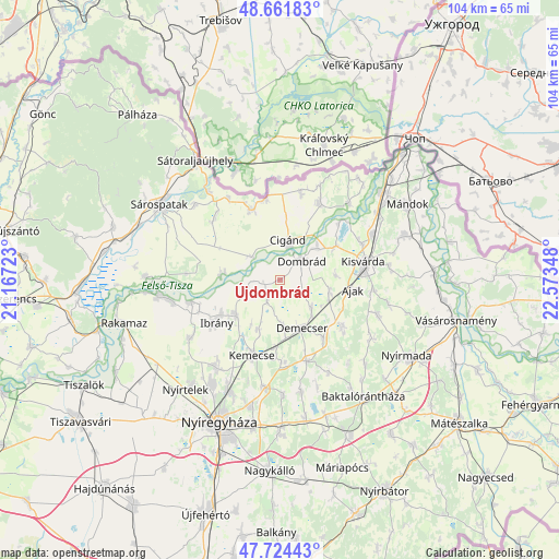
Újdombrád GPS coordinates[2]
48° 11' 42.972" North, 21° 52' 13.26" East
| Map corner | latitude | longitude |
|---|---|---|
| Upper-left | 48.66183°, | 21.16723° |
| Center: | 48.19527°, | 21.87035° |
| Lower-right: | 47.72443°, | 22.57348° |
| Map W x H: | 104.2×104.2 km | = 64.7×64.7mi |
| max Lat: | 48.46667° ⇑4.1% North |
| Újdombrád: | 48.19527° |
| min Lat: | ⇓95.9% South 45.79108° |
| min Long | Újdombrád | max Long |
| 16.27358° | 21.87035° | 22.68096° |
| W 92.4%⇐ | ⇒7.6% E |
Elevation
Elevation of Újdombrád is 95 m = 312 ft, and this is 34.7 m = 114 ft below average elevation for this country.
| Max E: |
444 m = 1457 ft | 80.4% |
| Avg. | 129.7 m = 426 ft | |
| Újdombrád | 95 m = 312 ft | |
Min E: |
71 m = 233 ft | 19.6% |
See also: Hungary elevation on elevation.city.
Geographical zone
Újdombrád is located in North temperate zone (between Tropic of Cancer and the Arctic Circle). Distance of this North polar circle is 2042.4 km =1269.1 mi to North.| Distance of | km | miles | from Újdombrád |
|---|---|---|---|
| North Pole | 4648.3 | 2888.3 | to North |
| Arctic Circle | 2042.4 | 1269.1 | to North |
| Tropic Cancer | 2752.9 | 1710.6 | to South |
| Equator | 5358.8 | 3329.8 | to South |


Nearby cities:
15 places around Újdombrád: (largest is in red/bold)
• Ajak
14.4 km =8.9 mi,  98°
98°
• Cigánd
6.9 km =4.3 mi,  13°
13°
• Demecser
9.7 km =6 mi,  154°
154°
• Dombrád
6.3 km =3.9 mi,  47°
47°
• Gégény
7.8 km =4.8 mi,  130°
130°
• Ibrány
14.4 km =8.9 mi,  236°
236°
• Karcsa
13.8 km =8.6 mi,  339°
339°
• Kemecse
14.2 km =8.8 mi,  199°
199°
• Kisvárda
16 km =9.9 mi,  81°
81°
• Kék
8.8 km =5.5 mi,  173°
173°
• Nagyhalász
10.7 km =6.6 mi,  229°
229°
• Nyírbogdány
15.4 km =9.6 mi,  176°
176°
• Nyírtass
14.9 km =9.3 mi, 125°
• Pátroha
10.1 km =6.3 mi,  108°
108°
• Tiszakarád
11.4 km =7.1 mi,  272°
272°
Sources, notices
• [Note1] Compared only with cities in Hungary existing in our database
• [Src1] Map data: © OpenStreetMap contributors (CC-BY-SA)
• [Src2] Other city data from geonames.org with taken over terms of usage.
• [Src3] Geographical zone / Annual Mean Temperature by Robert A. Rohde @ Wikipedia
