Karcsa geodata
Karcsa (Borsod-Abaúj-Zemplén) is a populated place; located in Hungary in Europe/Budapest (GMT+2) time zone. With population of 1,984 people, there are 796 cities with bigger population in this country. Compared to other cities in Hungary, 98.8% of cities are located further ↓South; 91.7% of cities are located further ←West and 72.5% of cities have higher elevation than Karcsa. Note1


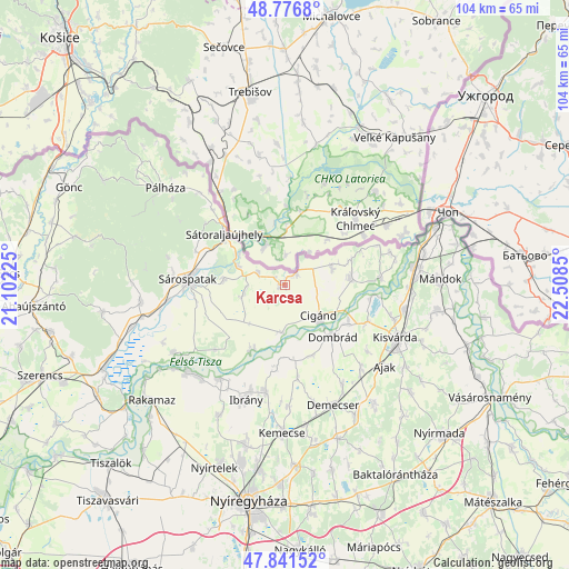
Karcsa GPS coordinates[2]
48° 18' 40.68" North, 21° 48' 19.332" East
| Map corner | latitude | longitude |
|---|---|---|
| Upper-left | 48.7768°, | 21.10225° |
| Center: | 48.3113°, | 21.80537° |
| Lower-right: | 47.84152°, | 22.5085° |
| Map W x H: | 104×104 km | = 64.6×64.6mi |
| max Lat: | 48.46667° ⇑1.2% North |
| Karcsa: | 48.3113° |
| min Lat: | ⇓98.8% South 45.79108° |
| min Long | Karcsa | max Long |
| 16.27358° | 21.80537° | 22.68096° |
| W 91.7%⇐ | ⇒8.3% E |
Elevation
Elevation of Karcsa is 100 m = 328 ft, and this is 29.7 m = 97 ft below average elevation for this country.
| Max E: |
444 m = 1457 ft | 72.5% |
| Avg. | 129.7 m = 426 ft | |
| Karcsa | 100 m = 328 ft | |
Min E: |
71 m = 233 ft | 27.5% |
See also: Hungary elevation on elevation.city.
Geographical zone
Karcsa is located in North temperate zone (between Tropic of Cancer and the Arctic Circle). Distance of this North polar circle is 2029.5 km =1261.1 mi to North.| Distance of | km | miles | from Karcsa |
|---|---|---|---|
| North Pole | 4635.3 | 2880.2 | to North |
| Arctic Circle | 2029.5 | 1261.1 | to North |
| Tropic Cancer | 2765.8 | 1718.6 | to South |
| Equator | 5371.7 | 3337.8 | to South |


Nearby cities:
15 places around Karcsa: (largest is in red/bold)
• Cigánd
8.9 km =5.5 mi,  134°
134°
• Dombrád
12.8 km =8 mi, 132°
• Döge
19.8 km =12.3 mi,  105°
105°
• Fényeslitke
22.3 km =13.9 mi,  101°
101°
• Gégény
20.9 km =13 mi,  149°
149°
• Ibrány
22.1 km =13.7 mi,  198°
198°
• Kék
22.4 km =13.9 mi,  165°
165°
• Nagyhalász
20.1 km =12.5 mi,  189°
189°
• Pátroha
21.6 km =13.4 mi,  138°
138°
• Ricse
12.3 km =7.6 mi,  82°
82°
• Sárospatak
17.2 km =10.7 mi,  274°
274°
• Sátoraljaújhely
14.3 km =8.9 mi,  310°
310°
• Tiszabercel
21.3 km =13.2 mi,  212°
212°
• Tiszakarád
14 km =8.7 mi, 207°
• Újdombrád
13.8 km =8.6 mi,  159°
159°
Sources, notices
• [Note1] Compared only with cities in Hungary existing in our database
• [Src1] Map data: © OpenStreetMap contributors (CC-BY-SA)
• [Src2] Other city data from geonames.org with taken over terms of usage.
• [Src3] Geographical zone / Annual Mean Temperature by Robert A. Rohde @ Wikipedia
