Nyírábrány geodata
Nyírábrány (Hajdú-Bihar) is a populated place; located in Hungary in Europe/Budapest (GMT+2) time zone. With population of 3,940 people, there are 383 cities with bigger population in this country. Compared to other cities in Hungary, 59.6% of cities are located further ↓South; 94.7% of cities are located further ←West and 68.8% of cities have lower elevation than Nyírábrány. Note1


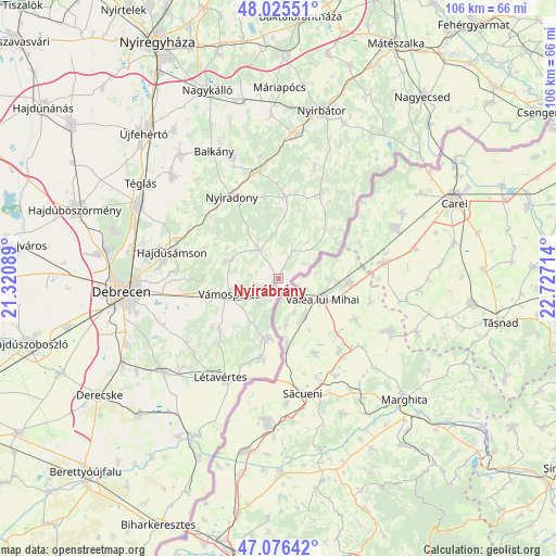
Nyírábrány GPS coordinates[2]
47° 33' 11.196" North, 22° 1' 26.436" East
| Map corner | latitude | longitude |
|---|---|---|
| Upper-left | 48.02551°, | 21.32089° |
| Center: | 47.55311°, | 22.02401° |
| Lower-right: | 47.07642°, | 22.72714° |
| Map W x H: | 105.5×105.5 km | = 65.6×65.6mi |
| max Lat: | 48.46667° ⇑40.4% North |
| Nyírábrány: | 47.55311° |
| min Lat: | ⇓59.6% South 45.79108° |
| min Long | Nyírábrány | max Long |
| 16.27358° | 22.02401° | 22.68096° |
| W 94.7%⇐ | ⇒5.3% E |
Elevation
Elevation of Nyírábrány is 136 m = 446 ft, and this is 6.3 m = 21 ft above average elevation for this country.
| Max E: |
444 m = 1457 ft | 31.2% |
| Nyírábrány | 136 m 446 ft | |
| Avg. | 129.7 m = 426 ft | |
Min E: |
71 m = 233 ft | 68.8% |
See also: Hungary elevation on elevation.city.
Geographical zone
Nyírábrány is located in North temperate zone (between Tropic of Cancer and the Arctic Circle). Distance of this North polar circle is 2113.8 km =1313.5 mi to North.| Distance of | km | miles | from Nyírábrány |
|---|---|---|---|
| North Pole | 4719.7 | 2932.7 | to North |
| Arctic Circle | 2113.8 | 1313.5 | to North |
| Tropic Cancer | 2681.5 | 1666.2 | to South |
| Equator | 5287.4 | 3285.4 | to South |


Nearby cities:
15 places around Nyírábrány: (largest is in red/bold)
• Bagamér
11.9 km =7.4 mi,  192°
192°
• Balkány
27 km =16.8 mi,  333°
333°
• Encsencs
21.2 km =13.2 mi,  19°
19°
• Hajdúsámson
20 km =12.4 mi,  285°
285°
• Létavértes
21.1 km =13.1 mi,  206°
206°
• Monostorpályi
24.8 km =15.4 mi,  226°
226°
• Nyíracsád
6.8 km =4.2 mi, 325°
• Nyíradony
17.9 km =11.1 mi, 333°
• Nyírbogát
28 km =17.4 mi,  6°
6°
• Nyírbéltek
18.3 km =11.4 mi,  26°
26°
• Nyírlugos
15.6 km =9.7 mi, 5°
• Nyírmihálydi
21.2 km =13.2 mi,  347°
347°
• Nyírmártonfalva
9.9 km =6.2 mi, 289°
• Szakoly
25.1 km =15.6 mi,  341°
341°
• Vámospércs
9.6 km =6 mi,  256°
256°
Sources, notices
• [Note1] Compared only with cities in Hungary existing in our database
• [Src1] Map data: © OpenStreetMap contributors (CC-BY-SA)
• [Src2] Other city data from geonames.org with taken over terms of usage.
• [Src3] Geographical zone / Annual Mean Temperature by Robert A. Rohde @ Wikipedia
