Kunmadaras geodata
Kunmadaras (Jász-Nagykun-Szolnok) is a populated place; located in Hungary in Europe/Budapest (GMT+2) time zone. With population of 5,826 people, there are 262 cities with bigger population in this country. Compared to other cities in Hungary, 51.3% of cities are located further ↓South; 76.6% of cities are located further ←West and 85.5% of cities have higher elevation than Kunmadaras. Note1


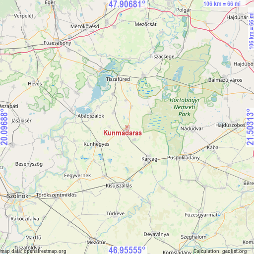
Kunmadaras GPS coordinates[2]
47° 25' 59.988" North, 20° 48' 0" East
| Map corner | latitude | longitude |
|---|---|---|
| Upper-left | 47.90681°, | 20.09688° |
| Center: | 47.43333°, | 20.8° |
| Lower-right: | 46.95555°, | 21.50313° |
| Map W x H: | 105.8×105.8 km | = 65.7×65.7mi |
| max Lat: | 48.46667° ⇑48.7% North |
| Kunmadaras: | 47.43333° |
| min Lat: | ⇓51.3% South 45.79108° |
| min Long | Kunmadaras | max Long |
| 16.27358° | 20.8° | 22.68096° |
| W 76.6%⇐ | ⇒23.4% E |
Elevation
Elevation of Kunmadaras is 90 m = 295 ft, and this is 39.7 m = 130 ft below average elevation for this country.
| Max E: |
444 m = 1457 ft | 85.5% |
| Avg. | 129.7 m = 426 ft | |
| Kunmadaras | 90 m = 295 ft | |
Min E: |
71 m = 233 ft | 14.5% |
See also: Hungary elevation on elevation.city.
Geographical zone
Kunmadaras is located in North temperate zone (between Tropic of Cancer and the Arctic Circle). Distance of this North polar circle is 2127.1 km =1321.7 mi to North.| Distance of | km | miles | from Kunmadaras |
|---|---|---|---|
| North Pole | 4733 | 2940.9 | to North |
| Arctic Circle | 2127.1 | 1321.7 | to North |
| Tropic Cancer | 2668.2 | 1657.9 | to South |
| Equator | 5274.1 | 3277.2 | to South |


Nearby cities:
15 places around Kunmadaras: (largest is in red/bold)
• Abádszalók
15.5 km =9.6 mi,  283°
283°
• Egyek
23.5 km =14.6 mi,  18°
18°
• Karcag
16.4 km =10.2 mi,  142°
142°
• Kenderes
22.2 km =13.8 mi,  203°
203°
• Kisköre
23.7 km =14.7 mi,  288°
288°
• Kisújszállás
24.2 km =15 mi,  185°
185°
• Kunhegyes
14.6 km =9.1 mi,  239°
239°
• Poroszló
26.1 km =16.2 mi,  337°
337°
• Püspökladány
27.1 km =16.8 mi,  118°
118°
• Tiszabura
25.1 km =15.6 mi,  274°
274°
• Tiszafüred
20.5 km =12.7 mi,  353°
353°
• Tiszanána
24.9 km =15.5 mi,  306°
306°
• Tiszaroff
26.6 km =16.5 mi,  261°
261°
• Tiszaszentimre
7.5 km =4.7 mi,  317°
317°
• Tiszaszőlős
15 km =9.3 mi, 336°
Sources, notices
• [Note1] Compared only with cities in Hungary existing in our database
• [Src1] Map data: © OpenStreetMap contributors (CC-BY-SA)
• [Src2] Other city data from geonames.org with taken over terms of usage.
• [Src3] Geographical zone / Annual Mean Temperature by Robert A. Rohde @ Wikipedia
