Apagy geodata
Apagy (Szabolcs-Szatmár-Bereg) is a populated place; located in Hungary in Europe/Budapest (GMT+2) time zone. With population of 2,348 people, there are 651 cities with bigger population in this country. Compared to other cities in Hungary, 85.8% of cities are located further ↓South; 93.6% of cities are located further ←West and 51.5% of cities have lower elevation than Apagy. Note1


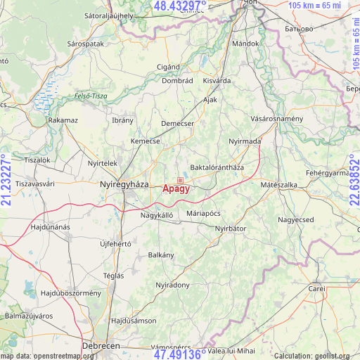
Apagy GPS coordinates[2]
47° 57' 51.516" North, 21° 56' 7.404" East
| Map corner | latitude | longitude |
|---|---|---|
| Upper-left | 48.43297°, | 21.23227° |
| Center: | 47.96431°, | 21.93539° |
| Lower-right: | 47.49136°, | 22.63852° |
| Map W x H: | 104.7×104.7 km | = 65.1×65.1mi |
| max Lat: | 48.46667° ⇑14.2% North |
| Apagy: | 47.96431° |
| min Lat: | ⇓85.8% South 45.79108° |
| min Long | Apagy | max Long |
| 16.27358° | 21.93539° | 22.68096° |
| W 93.6%⇐ | ⇒6.4% E |
Elevation
Elevation of Apagy is 117 m = 384 ft, and this is 12.7 m = 42 ft below average elevation for this country.
| Max E: |
444 m = 1457 ft | 48.5% |
| Avg. | 129.7 m = 426 ft | |
| Apagy | 117 m = 384 ft | |
Min E: |
71 m = 233 ft | 51.5% |
See also: Hungary elevation on elevation.city.
Geographical zone
Apagy is located in North temperate zone (between Tropic of Cancer and the Arctic Circle). Distance of this North polar circle is 2068 km =1285 mi to North.| Distance of | km | miles | from Apagy |
|---|---|---|---|
| North Pole | 4673.9 | 2904.2 | to North |
| Arctic Circle | 2068 | 1285 | to North |
| Tropic Cancer | 2727.2 | 1694.6 | to South |
| Equator | 5333.1 | 3313.8 | to South |


Nearby cities:
15 places around Apagy: (largest is in red/bold)
• Baktalórántháza
11.7 km =7.3 mi,  70°
70°
• Kemecse
15.6 km =9.7 mi,  322°
322°
• Kisléta
14.5 km =9 mi,  159°
159°
• Kállósemjén
11.5 km =7.1 mi,  178°
178°
• Kántorjánosi
16.3 km =10.1 mi,  102°
102°
• Levelek
3.7 km =2.3 mi,  92°
92°
• Máriapócs
11.2 km =7 mi,  143°
143°
• Nagykálló
12.2 km =7.6 mi,  215°
215°
• Napkor
5.8 km =3.6 mi,  239°
239°
• Nyírbogdány
11.1 km =6.9 mi,  339°
339°
• Nyíregyháza
16.3 km =10.1 mi,  266°
266°
• Nyírgyulaj
14.9 km =9.3 mi,  125°
125°
• Nyírpazony
10.3 km =6.4 mi,  281°
281°
• Petneháza
14.9 km =9.3 mi,  44°
44°
• Ófehértó
9.2 km =5.7 mi,  111°
111°
Sources, notices
• [Note1] Compared only with cities in Hungary existing in our database
• [Src1] Map data: © OpenStreetMap contributors (CC-BY-SA)
• [Src2] Other city data from geonames.org with taken over terms of usage.
• [Src3] Geographical zone / Annual Mean Temperature by Robert A. Rohde @ Wikipedia
