Bureng geodata
Bureng (East Java) is a seat of a fourth-order administrative division; located in Indonesia in Asia/Jakarta (GMT+7) time zone. In our database, there are 407 cities with bigger population. Compared to other cities in Indonesia, 66.6% of cities are located further ↑North; 56.2% of cities are located further ←West and 75.5% of cities have lower elevation than Bureng. Note1


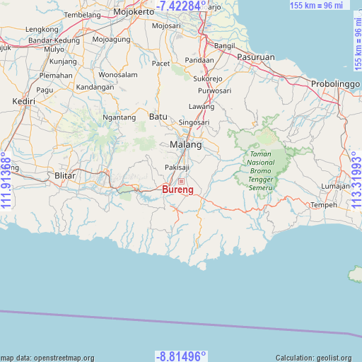
Bureng GPS coordinates[2]
8° 7' 10.2" South, 112° 37' 0.48" East
| Map corner | latitude | longitude |
|---|---|---|
| Upper-left | -7.42284°, | 111.91368° |
| Center: | -8.1195°, | 112.6168° |
| Lower-right: | -8.81496°, | 113.31993° |
| Map W x H: | 154.8×154.8 km | = 96.2×96.2mi |
| max Lat: | 5.88969° ⇑66.6% North |
| Bureng: | -8.1195° |
| min Lat: | ⇓33.4% South -10.934° |
| min Long | Bureng | max Long |
| 95.1345° | 112.6168° | 140.9419° |
| W 56.2%⇐ | ⇒43.8% E |
Elevation
Elevation of Bureng is 365 m = 1198 ft, and this is 135.3 m = 444 ft above average elevation for this country.
| Max E: |
3185 m = 10449 ft | 24.5% |
| Bureng | 365 m 1198 ft | |
| Avg. | 229.7 m = 754 ft | |
Min E: |
-1 m = -3 ft | 75.5% |
See also: Indonesia elevation on elevation.city.
Geographical zone
Bureng is located in South Torrid zone (between Equator and Tropic of Capricorn). Distance of Equator is 902.8 km =561 mi to North.| Distance of | km | miles | from Bureng |
|---|---|---|---|
| Equator | 902.8 | 561 | to North |
| Tropic Capricorn | 1703.1 | 1058.3 | to South |
| Antarctic Circle | 6498.4 | 4037.9 | to South |
| South Pole | 9104.3 | 5657.1 | to South |


Nearby cities:
15 places around Bureng: (largest is in red/bold)
• Bakalan
4.8 km =3 mi,  76°
76°
• Blobo
2.2 km =1.4 mi,  282°
282°
• Boro Utara
2.2 km =1.4 mi,  335°
335°
• Bulupitukrajan
2.2 km =1.4 mi,  226°
226°
• Gading
2.8 km =1.7 mi,  46°
46°
• Ganjaran
2.4 km =1.5 mi,  185°
185°
• Glanggang
4.6 km =2.9 mi,  334°
334°
• Ketawang
3.8 km =2.4 mi,  129°
129°
• Krapyak Kidul
4.4 km =2.7 mi, 49°
• Krebet
3.6 km =2.2 mi,  39°
39°
• Panggungrejo
3.4 km =2.1 mi,  211°
211°
• Penarukan
4.5 km =2.8 mi,  246°
246°
• Putukrejo
1.9 km =1.2 mi,  112°
112°
• Sidoaji
4 km =2.5 mi,  25°
25°
• Sukonolo Krajan
1.8 km =1.1 mi,  359°
359°
Sources, notices
• [Note1] Compared only with cities in Indonesia existing in our database
• [Src1] Map data: © OpenStreetMap contributors (CC-BY-SA)
• [Src2] Other city data from geonames.org with taken over terms of usage.
• [Src3] Geographical zone / Annual Mean Temperature by Robert A. Rohde @ Wikipedia
