Senggigi geodata
Senggigi (West Nusa Tenggara) is a populated place; located in Indonesia in Asia/Makassar (GMT+8) time zone. With population of 5,000 people, there are 386 cities with bigger population in this country. Compared to other cities in Indonesia, 83.1% of cities are located further ↑North; 75.9% of cities are located further ←West and 55.7% of cities have higher elevation than Senggigi. Note1


Senggigi GPS coordinates[2]
8° 29' 30.84" South, 116° 2' 32.64" East
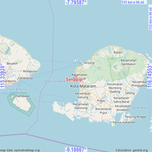
| Map corner | latitude | longitude |
|---|---|---|
| Upper-left | -7.79587°, | 115.33928° |
| Center: | -8.4919°, | 116.0424° |
| Lower-right: | -9.18667°, | 116.74553° |
| Map W x H: | 154.6×154.6 km | = 96.1×96.1mi |
| max Lat: | 5.88969° ⇑83.1% North |
| Senggigi: | -8.4919° |
| min Lat: | ⇓16.9% South -10.934° |
| min Long | Senggigi | max Long |
| 95.1345° | 116.0424° | 140.9419° |
| W 75.9%⇐ | ⇒24.1% E |
Elevation
Elevation of Senggigi is 80 m = 262 ft, and this is 149.7 m = 491 ft below average elevation for this country.
| Max E: |
3185 m = 10449 ft | 55.7% |
| Avg. | 229.7 m = 754 ft | |
| Senggigi | 80 m = 262 ft | |
Min E: |
-1 m = -3 ft | 44.3% |
See also: Indonesia elevation on elevation.city.
Geographical zone
Senggigi is located in South Torrid zone (between Equator and Tropic of Capricorn). Distance of Equator is 944.2 km =586.7 mi to North.| Distance of | km | miles | from Senggigi |
|---|---|---|---|
| Equator | 944.2 | 586.7 | to North |
| Tropic Capricorn | 1661.7 | 1032.5 | to South |
| Antarctic Circle | 6457 | 4012.2 | to South |
| South Pole | 9062.9 | 5631.4 | to South |


Nearby cities:
15 places around Senggigi: (largest is in red/bold)
• Dasangeria Selatan
13.6 km =8.5 mi,  121°
121°
• Dumandesa
14.2 km =8.8 mi, 124°
• Gili Air
15.5 km =9.6 mi,  16°
16°
• Gili Trawangan
15.9 km =9.9 mi,  357°
357°
• Karangkecicang
15.1 km =9.4 mi,  139°
139°
• Karangparwa
15.5 km =9.6 mi, 143°
• Karangsubagan
11.5 km =7.1 mi,  34°
34°
• Kekeri
11.9 km =7.4 mi,  127°
127°
• Mambalan
11.4 km =7.1 mi, 124°
• Mataram
13 km =8.1 mi, 141°
• Pemenang
11.8 km =7.3 mi, 34°
• Penimbung Barat
11.9 km =7.4 mi, 121°
• Sayang Lauq
13.1 km =8.1 mi, 131°
• Selagalas
14.9 km =9.3 mi, 131°
• Sindu
14.4 km =8.9 mi, 134°
Sources, notices
• [Note1] Compared only with cities in Indonesia existing in our database
• [Src1] Map data: © OpenStreetMap contributors (CC-BY-SA)
• [Src2] Other city data from geonames.org with taken over terms of usage.
• [Src3] Geographical zone / Annual Mean Temperature by Robert A. Rohde @ Wikipedia
