Karangsubagan geodata
Karangsubagan (West Nusa Tenggara) is a seat of a fourth-order administrative division; located in Indonesia in Asia/Makassar (GMT+8) time zone. In our database, there are 407 cities with bigger population. Compared to other cities in Indonesia, 80.5% of cities are located further ↑North; 76% of cities are located further ←West and 84.2% of cities have higher elevation than Karangsubagan. Note1


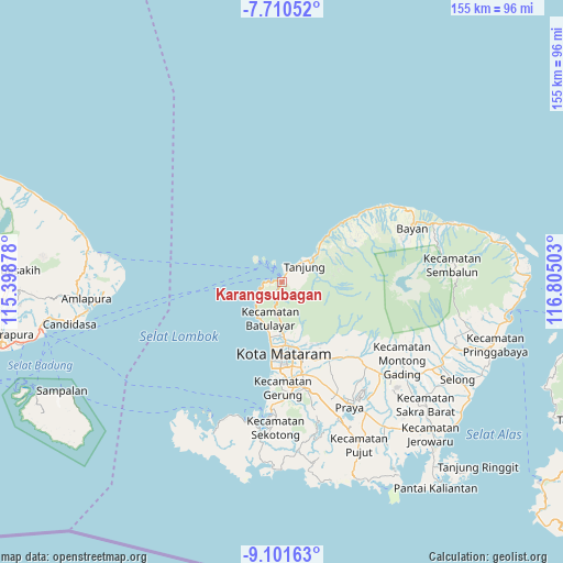
Karangsubagan GPS coordinates[2]
8° 24' 24.12" South, 116° 6' 6.84" East
| Map corner | latitude | longitude |
|---|---|---|
| Upper-left | -7.71052°, | 115.39878° |
| Center: | -8.4067°, | 116.1019° |
| Lower-right: | -9.10163°, | 116.80503° |
| Map W x H: | 154.7×154.7 km | = 96.1×96.1mi |
| max Lat: | 5.88969° ⇑80.5% North |
| Karangsubagan: | -8.4067° |
| min Lat: | ⇓19.5% South -10.934° |
| min Long | Karangsubagan | max Long |
| 95.1345° | 116.1019° | 140.9419° |
| W 76%⇐ | ⇒24% E |
Elevation
Elevation of Karangsubagan is 15 m = 49 ft, and this is 214.7 m = 704 ft below average elevation for this country.
| Max E: |
3185 m = 10449 ft | 84.2% |
| Avg. | 229.7 m = 754 ft | |
| Karangsubagan | 15 m = 49 ft | |
Min E: |
-1 m = -3 ft | 15.8% |
See also: Indonesia elevation on elevation.city.
Geographical zone
Karangsubagan is located in South Torrid zone (between Equator and Tropic of Capricorn). Distance of Equator is 934.7 km =580.8 mi to North.| Distance of | km | miles | from Karangsubagan |
|---|---|---|---|
| Equator | 934.7 | 580.8 | to North |
| Tropic Capricorn | 1671.2 | 1038.4 | to South |
| Antarctic Circle | 6466.4 | 4018 | to South |
| South Pole | 9072.3 | 5637.3 | to South |


Nearby cities:
15 places around Karangsubagan: (largest is in red/bold)
• Dasangeria Selatan
17.4 km =10.8 mi,  163°
163°
• Dumandesa
18.3 km =11.4 mi, 163°
• Gili Air
5.8 km =3.6 mi,  338°
338°
• Gili Trawangan
9.6 km =6 mi,  311°
311°
• Kekeri
17 km =10.6 mi,  170°
170°
• Mambalan
16.1 km =10 mi, 169°
• Mataram
19.7 km =12.2 mi,  175°
175°
• Pemenang
0.3 km =0.2 mi,  13°
13°
• Penimbung Barat
16.1 km =10 mi, 166°
• Prawira
6.9 km =4.3 mi,  42°
42°
• Sayang Lauq
18.4 km =11.4 mi, 169°
• Senggigi
11.5 km =7.1 mi,  214°
214°
• Tanahsong Daya
9.5 km =5.9 mi,  49°
49°
• Tanjung
8.2 km =5.1 mi, 46°
• Todo
9.6 km =6 mi,  66°
66°
Sources, notices
• [Note1] Compared only with cities in Indonesia existing in our database
• [Src1] Map data: © OpenStreetMap contributors (CC-BY-SA)
• [Src2] Other city data from geonames.org with taken over terms of usage.
• [Src3] Geographical zone / Annual Mean Temperature by Robert A. Rohde @ Wikipedia
