Kekeri geodata
Kekeri (West Nusa Tenggara) is a seat of a fourth-order administrative division; located in Indonesia in Asia/Makassar (GMT+8) time zone. In our database, there are 407 cities with bigger population. Compared to other cities in Indonesia, 85.5% of cities are located further ↑North; 76% of cities are located further ←West and 66.8% of cities have higher elevation than Kekeri. Note1


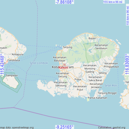
Kekeri GPS coordinates[2]
8° 33' 25.2" South, 116° 7' 40.08" East
| Map corner | latitude | longitude |
|---|---|---|
| Upper-left | -7.86108°, | 115.42468° |
| Center: | -8.557°, | 116.1278° |
| Lower-right: | -9.25165°, | 116.83093° |
| Map W x H: | 154.6×154.6 km | = 96.1×96.1mi |
| max Lat: | 5.88969° ⇑85.5% North |
| Kekeri: | -8.557° |
| min Lat: | ⇓14.5% South -10.934° |
| min Long | Kekeri | max Long |
| 95.1345° | 116.1278° | 140.9419° |
| W 76%⇐ | ⇒24% E |
Elevation
Elevation of Kekeri is 38 m = 125 ft, and this is 191.7 m = 629 ft below average elevation for this country.
| Max E: |
3185 m = 10449 ft | 66.8% |
| Avg. | 229.7 m = 754 ft | |
| Kekeri | 38 m = 125 ft | |
Min E: |
-1 m = -3 ft | 33.2% |
See also: Indonesia elevation on elevation.city.
Geographical zone
Kekeri is located in South Torrid zone (between Equator and Tropic of Capricorn). Distance of Equator is 951.4 km =591.2 mi to North.| Distance of | km | miles | from Kekeri |
|---|---|---|---|
| Equator | 951.4 | 591.2 | to North |
| Tropic Capricorn | 1654.5 | 1028.1 | to South |
| Antarctic Circle | 6449.7 | 4007.7 | to South |
| South Pole | 9055.6 | 5626.9 | to South |


Nearby cities:
15 places around Kekeri: (largest is in red/bold)
• Babakan Barat
5.1 km =3.2 mi,  168°
168°
• Bengkel Utara
6.9 km =4.3 mi,  161°
161°
• Dasangeria Selatan
2.2 km =1.4 mi,  87°
87°
• Dumandesa
2.5 km =1.6 mi,  109°
109°
• Jejelok
7.4 km =4.6 mi,  145°
145°
• Karangkebon Timur
7.8 km =4.8 mi, 172°
• Karangkecicang
4.3 km =2.7 mi, 174°
• Karangparwa
5.2 km =3.2 mi,  180°
180°
• Lingsar
6.3 km =3.9 mi, 106°
• Mambalan
0.8 km =0.5 mi,  2°
2°
• Mataram
3.2 km =2 mi,  202°
202°
• Penimbung Barat
1.3 km =0.8 mi,  37°
37°
• Sayang Lauq
1.5 km =0.9 mi, 159°
• Selagalas
3.2 km =2 mi, 147°
• Sindu
3 km =1.9 mi, 164°
Sources, notices
• [Note1] Compared only with cities in Indonesia existing in our database
• [Src1] Map data: © OpenStreetMap contributors (CC-BY-SA)
• [Src2] Other city data from geonames.org with taken over terms of usage.
• [Src3] Geographical zone / Annual Mean Temperature by Robert A. Rohde @ Wikipedia
