Jengglungharjo geodata
Jengglungharjo (East Java) is a seat of a fourth-order administrative division; located in Indonesia in Asia/Jakarta (GMT+7) time zone. In our database, there are 407 cities with bigger population. Compared to other cities in Indonesia, 73.9% of cities are located further ↑North; 51.5% of cities are located further →East and 66.2% of cities have lower elevation than Jengglungharjo. Note1


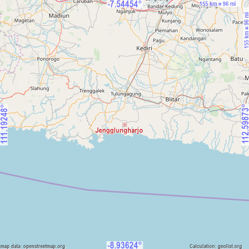
Jengglungharjo GPS coordinates[2]
8° 14' 27.6" South, 111° 53' 44.16" East
| Map corner | latitude | longitude |
|---|---|---|
| Upper-left | -7.54454°, | 111.19248° |
| Center: | -8.241°, | 111.8956° |
| Lower-right: | -8.93624°, | 112.59873° |
| Map W x H: | 154.7×154.7 km | = 96.1×96.1mi |
| max Lat: | 5.88969° ⇑73.9% North |
| Jengglungharjo: | -8.241° |
| min Lat: | ⇓26.1% South -10.934° |
| min Long | Jengglungharjo | max Long |
| 95.1345° | 111.8956° | 140.9419° |
| W 48.5%⇐ | ⇒51.5% E |
Elevation
Elevation of Jengglungharjo is 241 m = 791 ft, and this is 11.3 m = 37 ft above average elevation for this country.
| Max E: |
3185 m = 10449 ft | 33.8% |
| Jengglungharjo | 241 m 791 ft | |
| Avg. | 229.7 m = 754 ft | |
Min E: |
-1 m = -3 ft | 66.2% |
See also: Indonesia elevation on elevation.city.
Geographical zone
Jengglungharjo is located in South Torrid zone (between Equator and Tropic of Capricorn). Distance of Equator is 916.3 km =569.4 mi to North.| Distance of | km | miles | from Jengglungharjo |
|---|---|---|---|
| Equator | 916.3 | 569.4 | to North |
| Tropic Capricorn | 1689.6 | 1049.9 | to South |
| Antarctic Circle | 6484.9 | 4029.5 | to South |
| South Pole | 9090.7 | 5648.7 | to South |


Nearby cities:
15 places around Jengglungharjo: (largest is in red/bold)
• Besole
8.6 km =5.3 mi,  282°
282°
• Darungan
5.1 km =3.2 mi,  65°
65°
• Jatirejo
6.8 km =4.2 mi,  345°
345°
• Kemiri
2.3 km =1.4 mi,  47°
47°
• Krajan
2 km =1.2 mi,  321°
321°
• Ngayem
5.6 km =3.5 mi,  334°
334°
• Ngentrong
8.4 km =5.2 mi,  294°
294°
• Ngepoh Kidul
4.8 km =3 mi, 318°
• Ngrejo
4.9 km =3 mi, 286°
• Ngrejo
8.8 km =5.5 mi,  36°
36°
• Sawo
8.1 km =5 mi,  302°
302°
• Tanggunggunung
3.3 km =2.1 mi, 318°
• Tekik Wetan
7 km =4.3 mi,  75°
75°
• Tekikbanyuurip
6.4 km =4 mi, 70°
• Tumpakjoho
6.4 km =4 mi,  18°
18°
Sources, notices
• [Note1] Compared only with cities in Indonesia existing in our database
• [Src1] Map data: © OpenStreetMap contributors (CC-BY-SA)
• [Src2] Other city data from geonames.org with taken over terms of usage.
• [Src3] Geographical zone / Annual Mean Temperature by Robert A. Rohde @ Wikipedia
