Tanjung Timur geodata
Tanjung Timur (Central Java) is a seat of a fourth-order administrative division; located in Indonesia in Asia/Jakarta (GMT+7) time zone. In our database, there are 407 cities with bigger population. Compared to other cities in Indonesia, 55.7% of cities are located further ↓South; 57.9% of cities are located further →East and 62.1% of cities have higher elevation than Tanjung Timur. Note1


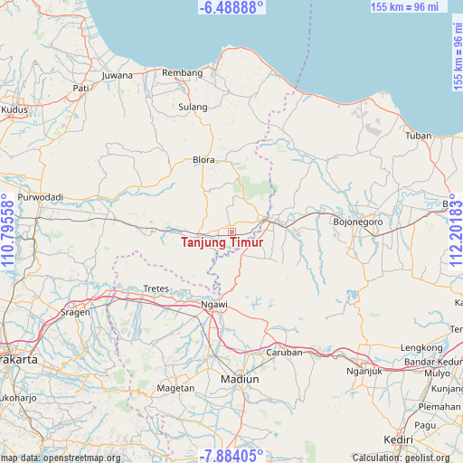
Tanjung Timur GPS coordinates[2]
7° 11' 13.2" South, 111° 29' 55.32" East
| Map corner | latitude | longitude |
|---|---|---|
| Upper-left | -6.48888°, | 110.79558° |
| Center: | -7.187°, | 111.4987° |
| Lower-right: | -7.88405°, | 112.20183° |
| Map W x H: | 155.1×155.1 km | = 96.4×96.4mi |
| max Lat: | 5.88969° ⇑44.3% North |
| Tanjung Timur: | -7.187° |
| min Lat: | ⇓55.7% South -10.934° |
| min Long | Tanjung Timur | max Long |
| 95.1345° | 111.4987° | 140.9419° |
| W 42.1%⇐ | ⇒57.9% E |
Elevation
Elevation of Tanjung Timur is 51 m = 167 ft, and this is 178.7 m = 586 ft below average elevation for this country.
| Max E: |
3185 m = 10449 ft | 62.1% |
| Avg. | 229.7 m = 754 ft | |
| Tanjung Timur | 51 m = 167 ft | |
Min E: |
-1 m = -3 ft | 37.9% |
See also: Indonesia elevation on elevation.city.
Geographical zone
Tanjung Timur is located in South Torrid zone (between Equator and Tropic of Capricorn). Distance of Equator is 799.1 km =496.5 mi to North.| Distance of | km | miles | from Tanjung Timur |
|---|---|---|---|
| Equator | 799.1 | 496.5 | to North |
| Tropic Capricorn | 1806.8 | 1122.7 | to South |
| Antarctic Circle | 6602.1 | 4102.4 | to South |
| South Pole | 9207.9 | 5721.5 | to South |


Nearby cities:
15 places around Tanjung Timur: (largest is in red/bold)
• Balangpule
1.6 km =1 mi,  8°
8°
• Gondel
4.7 km =2.9 mi,  185°
185°
• Jetis
3.7 km =2.3 mi,  145°
145°
• Kedungtuban
2.6 km =1.6 mi,  348°
348°
• Kemantren
3.3 km =2.1 mi,  138°
138°
• Ketuwan
5.2 km =3.2 mi,  166°
166°
• Klagen
4.4 km =2.7 mi,  130°
130°
• Mojorembun
5.4 km =3.4 mi,  214°
214°
• Ngraho
1.8 km =1.1 mi, 354°
• Panolan
5.7 km =3.5 mi, 137°
• Peting
4.3 km =2.7 mi,  279°
279°
• Pulo
0.3 km =0.2 mi,  175°
175°
• Seren
5.4 km =3.4 mi,  52°
52°
• Sugihwaras
5 km =3.1 mi,  89°
89°
• Tapelan
6 km =3.7 mi, 140°
Sources, notices
• [Note1] Compared only with cities in Indonesia existing in our database
• [Src1] Map data: © OpenStreetMap contributors (CC-BY-SA)
• [Src2] Other city data from geonames.org with taken over terms of usage.
• [Src3] Geographical zone / Annual Mean Temperature by Robert A. Rohde @ Wikipedia
