Seren geodata
Seren (Central Java) is a seat of a fourth-order administrative division; located in Indonesia in Asia/Jakarta (GMT+7) time zone. In our database, there are 407 cities with bigger population. Compared to other cities in Indonesia, 57.2% of cities are located further ↓South; 57.2% of cities are located further →East and 58.8% of cities have higher elevation than Seren. Note1


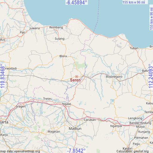
Seren GPS coordinates[2]
7° 9' 25.56" South, 111° 32' 16.08" East
| Map corner | latitude | longitude |
|---|---|---|
| Upper-left | -6.45894°, | 110.83468° |
| Center: | -7.1571°, | 111.5378° |
| Lower-right: | -7.8542°, | 112.24093° |
| Map W x H: | 155.1×155.1 km | = 96.4×96.4mi |
| max Lat: | 5.88969° ⇑42.8% North |
| Seren: | -7.1571° |
| min Lat: | ⇓57.2% South -10.934° |
| min Long | Seren | max Long |
| 95.1345° | 111.5378° | 140.9419° |
| W 42.8%⇐ | ⇒57.2% E |
Elevation
Elevation of Seren is 64 m = 210 ft, and this is 165.7 m = 544 ft below average elevation for this country.
| Max E: |
3185 m = 10449 ft | 58.8% |
| Avg. | 229.7 m = 754 ft | |
| Seren | 64 m = 210 ft | |
Min E: |
-1 m = -3 ft | 41.2% |
See also: Indonesia elevation on elevation.city.
Geographical zone
Seren is located in South Torrid zone (between Equator and Tropic of Capricorn). Distance of Equator is 795.8 km =494.5 mi to North.| Distance of | km | miles | from Seren |
|---|---|---|---|
| Equator | 795.8 | 494.5 | to North |
| Tropic Capricorn | 1810.1 | 1124.7 | to South |
| Antarctic Circle | 6605.4 | 4104.4 | to South |
| South Pole | 9211.3 | 5723.6 | to South |


Nearby cities:
15 places around Seren: (largest is in red/bold)
• Balangpule
4.4 km =2.7 mi,  247°
247°
• Cepu
5.9 km =3.7 mi,  79°
79°
• Kapuan
4.2 km =2.6 mi,  149°
149°
• Kedungtuban
4.9 km =3 mi,  260°
260°
• Kentongan
2.7 km =1.7 mi,  110°
110°
• Mernung
1.1 km =0.7 mi,  74°
74°
• Mulyorejo
3 km =1.9 mi,  93°
93°
• Nglanjuk
5.3 km =3.3 mi,  101°
101°
• Ngraho
4.7 km =2.9 mi, 251°
• Pulo
5.6 km =3.5 mi,  229°
229°
• Sugihwaras
3.3 km =2.1 mi,  168°
168°
• Sumberpitu
5.7 km =3.5 mi,  122°
122°
• Tambakkromo
3.6 km =2.2 mi, 90°
• Tanjung Timur
5.4 km =3.4 mi, 232°
• Tebon
4.7 km =2.9 mi,  137°
137°
Sources, notices
• [Note1] Compared only with cities in Indonesia existing in our database
• [Src1] Map data: © OpenStreetMap contributors (CC-BY-SA)
• [Src2] Other city data from geonames.org with taken over terms of usage.
• [Src3] Geographical zone / Annual Mean Temperature by Robert A. Rohde @ Wikipedia
