Ngujung geodata
Ngujung (East Java) is a seat of a fourth-order administrative division; located in Indonesia in Asia/Jakarta (GMT+7) time zone. In our database, there are 407 cities with bigger population. Compared to other cities in Indonesia, 58.9% of cities are located further ↓South; 54.3% of cities are located further →East and 74.1% of cities have higher elevation than Ngujung. Note1


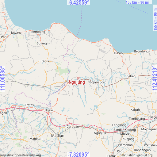
Ngujung GPS coordinates[2]
7° 7' 25.68" South, 111° 42' 32.4" East
| Map corner | latitude | longitude |
|---|---|---|
| Upper-left | -6.42559°, | 111.00588° |
| Center: | -7.1238°, | 111.709° |
| Lower-right: | -7.82095°, | 112.41213° |
| Map W x H: | 155.1×155.2 km | = 96.4×96.4mi |
| max Lat: | 5.88969° ⇑41.1% North |
| Ngujung: | -7.1238° |
| min Lat: | ⇓58.9% South -10.934° |
| min Long | Ngujung | max Long |
| 95.1345° | 111.709° | 140.9419° |
| W 45.7%⇐ | ⇒54.3% E |
Elevation
Elevation of Ngujung is 26 m = 85 ft, and this is 203.7 m = 668 ft below average elevation for this country.
| Max E: |
3185 m = 10449 ft | 74.1% |
| Avg. | 229.7 m = 754 ft | |
| Ngujung | 26 m = 85 ft | |
Min E: |
-1 m = -3 ft | 25.9% |
See also: Indonesia elevation on elevation.city.
Geographical zone
Ngujung is located in South Torrid zone (between Equator and Tropic of Capricorn). Distance of Equator is 792.1 km =492.2 mi to North.| Distance of | km | miles | from Ngujung |
|---|---|---|---|
| Equator | 792.1 | 492.2 | to North |
| Tropic Capricorn | 1813.8 | 1127 | to South |
| Antarctic Circle | 6609.1 | 4106.7 | to South |
| South Pole | 9215 | 5725.9 | to South |


Nearby cities:
15 places around Ngujung: (largest is in red/bold)
• Celangap
2.4 km =1.5 mi,  128°
128°
• Cengungklung
1.7 km =1.1 mi,  162°
162°
• Gotak
4 km =2.5 mi,  66°
66°
• Karuk
2.5 km =1.6 mi,  53°
53°
• Katur
4 km =2.5 mi, 163°
• Kembangan
3.4 km =2.1 mi,  218°
218°
• Kliteh
0.8 km =0.5 mi,  241°
241°
• Ledok
4.1 km =2.5 mi, 48°
• Malo
3.1 km =1.9 mi, 53°
• Ringintunggal
5.2 km =3.2 mi,  175°
175°
• Semanding
3.4 km =2.1 mi,  228°
228°
• Sudah
1.6 km =1 mi, 73°
• Talok
4.2 km =2.6 mi,  92°
92°
• Tambakmerak
5.1 km =3.2 mi,  280°
280°
• Telumbung
1.5 km =0.9 mi, 183°
Sources, notices
• [Note1] Compared only with cities in Indonesia existing in our database
• [Src1] Map data: © OpenStreetMap contributors (CC-BY-SA)
• [Src2] Other city data from geonames.org with taken over terms of usage.
• [Src3] Geographical zone / Annual Mean Temperature by Robert A. Rohde @ Wikipedia
