Kliteh geodata
Kliteh (East Java) is a seat of a fourth-order administrative division; located in Indonesia in Asia/Jakarta (GMT+7) time zone. In our database, there are 407 cities with bigger population. Compared to other cities in Indonesia, 58.8% of cities are located further ↓South; 54.5% of cities are located further →East and 73.4% of cities have higher elevation than Kliteh. Note1


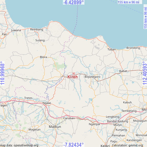
Kliteh GPS coordinates[2]
7° 7' 37.92" South, 111° 42' 10.08" East
| Map corner | latitude | longitude |
|---|---|---|
| Upper-left | -6.42899°, | 110.99968° |
| Center: | -7.1272°, | 111.7028° |
| Lower-right: | -7.82434°, | 112.40593° |
| Map W x H: | 155.1×155.2 km | = 96.4×96.4mi |
| max Lat: | 5.88969° ⇑41.2% North |
| Kliteh: | -7.1272° |
| min Lat: | ⇓58.8% South -10.934° |
| min Long | Kliteh | max Long |
| 95.1345° | 111.7028° | 140.9419° |
| W 45.5%⇐ | ⇒54.5% E |
Elevation
Elevation of Kliteh is 27 m = 89 ft, and this is 202.7 m = 665 ft below average elevation for this country.
| Max E: |
3185 m = 10449 ft | 73.4% |
| Avg. | 229.7 m = 754 ft | |
| Kliteh | 27 m = 89 ft | |
Min E: |
-1 m = -3 ft | 26.6% |
See also: Indonesia elevation on elevation.city.
Geographical zone
Kliteh is located in South Torrid zone (between Equator and Tropic of Capricorn). Distance of Equator is 792.5 km =492.4 mi to North.| Distance of | km | miles | from Kliteh |
|---|---|---|---|
| Equator | 792.5 | 492.4 | to North |
| Tropic Capricorn | 1813.4 | 1126.8 | to South |
| Antarctic Circle | 6608.7 | 4106.5 | to South |
| South Pole | 9214.6 | 5725.7 | to South |


Nearby cities:
15 places around Kliteh: (largest is in red/bold)
• Celangap
2.8 km =1.7 mi,  113°
113°
• Cengungklung
1.8 km =1.1 mi,  137°
137°
• Gotak
4.7 km =2.9 mi,  65°
65°
• Kacangan Lor
4.4 km =2.7 mi,  240°
240°
• Karuk
3.2 km =2 mi,  55°
55°
• Katur
3.9 km =2.4 mi,  152°
152°
• Kembangan
2.7 km =1.7 mi,  211°
211°
• Ledok
4.9 km =3 mi,  50°
50°
• Malo
3.9 km =2.4 mi, 54°
• Ngujung
0.8 km =0.5 mi, 61°
• Semanding
2.7 km =1.7 mi,  225°
225°
• Sudah
2.3 km =1.4 mi, 69°
• Suroh
4.8 km =3 mi,  261°
261°
• Tambakmerak
4.5 km =2.8 mi,  286°
286°
• Telumbung
1.3 km =0.8 mi, 152°
Sources, notices
• [Note1] Compared only with cities in Indonesia existing in our database
• [Src1] Map data: © OpenStreetMap contributors (CC-BY-SA)
• [Src2] Other city data from geonames.org with taken over terms of usage.
• [Src3] Geographical zone / Annual Mean Temperature by Robert A. Rohde @ Wikipedia
