Cengungklung geodata
Cengungklung (East Java) is a seat of a fourth-order administrative division; located in Indonesia in Asia/Jakarta (GMT+7) time zone. In our database, there are 407 cities with bigger population. Compared to other cities in Indonesia, 58.1% of cities are located further ↓South; 54.2% of cities are located further →East and 74.9% of cities have higher elevation than Cengungklung. Note1


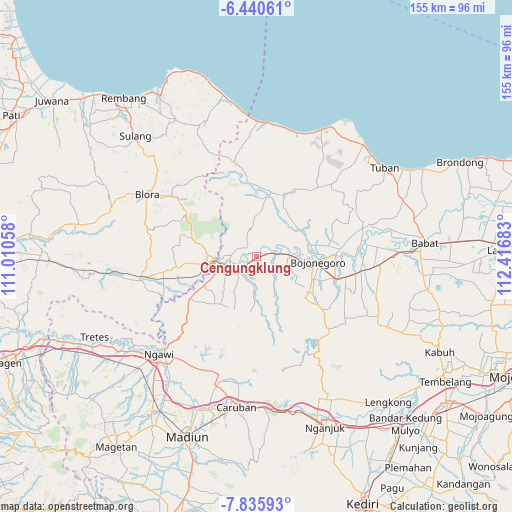
Cengungklung GPS coordinates[2]
7° 8' 19.68" South, 111° 42' 49.32" East
| Map corner | latitude | longitude |
|---|---|---|
| Upper-left | -6.44061°, | 111.01058° |
| Center: | -7.1388°, | 111.7137° |
| Lower-right: | -7.83593°, | 112.41683° |
| Map W x H: | 155.1×155.1 km | = 96.4×96.4mi |
| max Lat: | 5.88969° ⇑41.9% North |
| Cengungklung: | -7.1388° |
| min Lat: | ⇓58.1% South -10.934° |
| min Long | Cengungklung | max Long |
| 95.1345° | 111.7137° | 140.9419° |
| W 45.8%⇐ | ⇒54.2% E |
Elevation
Elevation of Cengungklung is 25 m = 82 ft, and this is 204.7 m = 672 ft below average elevation for this country.
| Max E: |
3185 m = 10449 ft | 74.9% |
| Avg. | 229.7 m = 754 ft | |
| Cengungklung | 25 m = 82 ft | |
Min E: |
-1 m = -3 ft | 25.1% |
See also: Indonesia elevation on elevation.city.
Geographical zone
Cengungklung is located in South Torrid zone (between Equator and Tropic of Capricorn). Distance of Equator is 793.8 km =493.2 mi to North.| Distance of | km | miles | from Cengungklung |
|---|---|---|---|
| Equator | 793.8 | 493.2 | to North |
| Tropic Capricorn | 1812.2 | 1126 | to South |
| Antarctic Circle | 6607.4 | 4105.6 | to South |
| South Pole | 9213.3 | 5724.9 | to South |


Nearby cities:
15 places around Cengungklung: (largest is in red/bold)
• Celangap
1.4 km =0.9 mi,  82°
82°
• Gayam
4.2 km =2.6 mi,  180°
180°
• Gotak
4.5 km =2.8 mi,  43°
43°
• Karuk
3.5 km =2.2 mi,  24°
24°
• Katur
2.3 km =1.4 mi,  164°
164°
• Kembangan
2.8 km =1.7 mi,  249°
249°
• Kliteh
1.8 km =1.1 mi,  317°
317°
• Ledok
5.1 km =3.2 mi,  30°
30°
• Malo
4 km =2.5 mi, 29°
• Ngujung
1.7 km =1.1 mi,  342°
342°
• Ringintunggal
3.5 km =2.2 mi, 182°
• Semanding
3.2 km =2 mi,  259°
259°
• Sudah
2.3 km =1.4 mi, 24°
• Talok
4 km =2.5 mi,  68°
68°
• Telumbung
0.6 km =0.4 mi,  283°
283°
Sources, notices
• [Note1] Compared only with cities in Indonesia existing in our database
• [Src1] Map data: © OpenStreetMap contributors (CC-BY-SA)
• [Src2] Other city data from geonames.org with taken over terms of usage.
• [Src3] Geographical zone / Annual Mean Temperature by Robert A. Rohde @ Wikipedia
