Peneng geodata
Peneng (Bali) is a seat of a fourth-order administrative division; located in Indonesia in Asia/Makassar (GMT+8) time zone. In our database, there are 407 cities with bigger population. Compared to other cities in Indonesia, 79.7% of cities are located further ↑North; 72.5% of cities are located further ←West and 87.7% of cities have lower elevation than Peneng. Note1


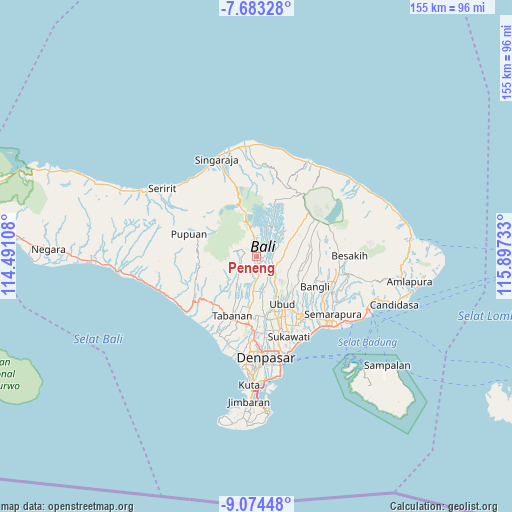
Peneng GPS coordinates[2]
8° 22' 46.2" South, 115° 11' 39.12" East
| Map corner | latitude | longitude |
|---|---|---|
| Upper-left | -7.68328°, | 114.49108° |
| Center: | -8.3795°, | 115.1942° |
| Lower-right: | -9.07448°, | 115.89733° |
| Map W x H: | 154.7×154.7 km | = 96.1×96.1mi |
| max Lat: | 5.88969° ⇑79.7% North |
| Peneng: | -8.3795° |
| min Lat: | ⇓20.3% South -10.934° |
| min Long | Peneng | max Long |
| 95.1345° | 115.1942° | 140.9419° |
| W 72.5%⇐ | ⇒27.5% E |
Elevation
Elevation of Peneng is 576 m = 1890 ft, and this is 346.3 m = 1136 ft above average elevation for this country.
| Max E: |
3185 m = 10449 ft | 12.3% |
| Peneng | 576 m 1890 ft | |
| Avg. | 229.7 m = 754 ft | |
Min E: |
-1 m = -3 ft | 87.7% |
See also: Indonesia elevation on elevation.city.
Geographical zone
Peneng is located in South Torrid zone (between Equator and Tropic of Capricorn). Distance of Equator is 931.7 km =578.9 mi to North.| Distance of | km | miles | from Peneng |
|---|---|---|---|
| Equator | 931.7 | 578.9 | to North |
| Tropic Capricorn | 1674.2 | 1040.3 | to South |
| Antarctic Circle | 6469.5 | 4020 | to South |
| South Pole | 9075.3 | 5639.1 | to South |


Nearby cities:
15 places around Peneng: (largest is in red/bold)
• Banjar Angseri
4.1 km =2.5 mi,  305°
305°
• Banjar Apuan
2.1 km =1.3 mi,  302°
302°
• Banjar Bangli
5.4 km =3.4 mi,  340°
340°
• Banjar Buahan
5 km =3.1 mi,  109°
109°
• Banjar Senganan Kangin
3.8 km =2.4 mi,  288°
288°
• Banjar Tohjiwo
5.9 km =3.7 mi,  3°
3°
• Baturiti
6.2 km =3.9 mi,  351°
351°
• Beaung Tengah
5.9 km =3.7 mi,  218°
218°
• Empalan
5 km =3.1 mi,  249°
249°
• Luwus
2.1 km =1.3 mi,  175°
175°
• Pangsan
4.9 km =3 mi,  143°
143°
• Pergan
5.2 km =3.2 mi, 179°
• Petang
3.3 km =2.1 mi,  124°
124°
• Tua
3.8 km =2.4 mi,  202°
202°
• Tuka
5.9 km =3.7 mi, 175°
Sources, notices
• [Note1] Compared only with cities in Indonesia existing in our database
• [Src1] Map data: © OpenStreetMap contributors (CC-BY-SA)
• [Src2] Other city data from geonames.org with taken over terms of usage.
• [Src3] Geographical zone / Annual Mean Temperature by Robert A. Rohde @ Wikipedia
