Montonggedeng geodata
Montonggedeng (West Nusa Tenggara) is a seat of a fourth-order administrative division; located in Indonesia in Asia/Makassar (GMT+8) time zone. In our database, there are 407 cities with bigger population. Compared to other cities in Indonesia, 84.8% of cities are located further ↑North; 77.9% of cities are located further ←West and 65.3% of cities have lower elevation than Montonggedeng. Note1


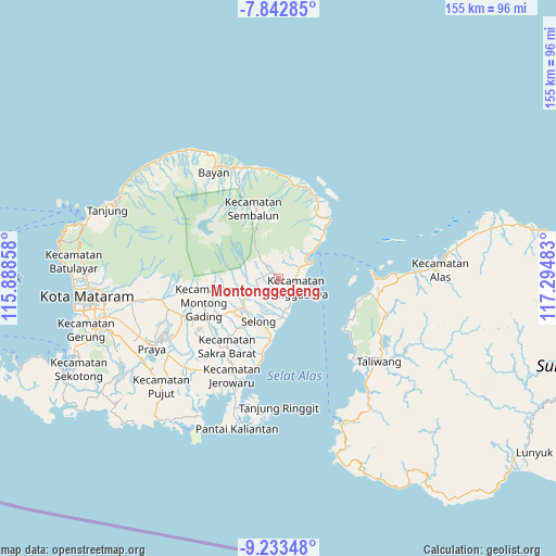
Montonggedeng GPS coordinates[2]
8° 32' 19.68" South, 116° 35' 30.12" East
| Map corner | latitude | longitude |
|---|---|---|
| Upper-left | -7.84285°, | 115.88858° |
| Center: | -8.5388°, | 116.5917° |
| Lower-right: | -9.23348°, | 117.29483° |
| Map W x H: | 154.6×154.6 km | = 96.1×96.1mi |
| max Lat: | 5.88969° ⇑84.8% North |
| Montonggedeng: | -8.5388° |
| min Lat: | ⇓15.2% South -10.934° |
| min Long | Montonggedeng | max Long |
| 95.1345° | 116.5917° | 140.9419° |
| W 77.9%⇐ | ⇒22.1% E |
Elevation
Elevation of Montonggedeng is 226 m = 741 ft, and this is 3.7 m = 12 ft below average elevation for this country.
| Max E: |
3185 m = 10449 ft | 34.7% |
| Avg. | 229.7 m = 754 ft | |
| Montonggedeng | 226 m = 741 ft | |
Min E: |
-1 m = -3 ft | 65.3% |
See also: Indonesia elevation on elevation.city.
Geographical zone
Montonggedeng is located in South Torrid zone (between Equator and Tropic of Capricorn). Distance of Equator is 949.4 km =589.9 mi to North.| Distance of | km | miles | from Montonggedeng |
|---|---|---|---|
| Equator | 949.4 | 589.9 | to North |
| Tropic Capricorn | 1656.5 | 1029.3 | to South |
| Antarctic Circle | 6451.7 | 4008.9 | to South |
| South Pole | 9057.6 | 5628.1 | to South |


Nearby cities:
15 places around Montonggedeng: (largest is in red/bold)
• Aikmel
7.5 km =4.7 mi,  244°
244°
• Bagikkedok Lauk
4 km =2.5 mi,  157°
157°
• Batubasong Lauk
1.6 km =1 mi,  323°
323°
• Dasanlian Lauk
8.1 km =5 mi,  260°
260°
• Gelumpang
9.8 km =6.1 mi,  229°
229°
• Gubuk Daya
2.6 km =1.6 mi,  308°
308°
• Gubuk Daya
4.9 km =3 mi,  133°
133°
• Gubuk Leuk
9 km =5.6 mi,  168°
168°
• Jorong Lauk
3.6 km =2.2 mi,  210°
210°
• Kampungbaru
9 km =5.6 mi,  62°
62°
• Kembangkerang Lauk Timur
6.3 km =3.9 mi,  249°
249°
• Labuan Lombok
9.3 km =5.8 mi, 62°
• Montongkemong
6.8 km =4.2 mi, 322°
• Pringgabaya
4.9 km =3 mi,  114°
114°
• Selaparang Timur
1.5 km =0.9 mi, 134°
Sources, notices
• [Note1] Compared only with cities in Indonesia existing in our database
• [Src1] Map data: © OpenStreetMap contributors (CC-BY-SA)
• [Src2] Other city data from geonames.org with taken over terms of usage.
• [Src3] Geographical zone / Annual Mean Temperature by Robert A. Rohde @ Wikipedia
