Botoh geodata
Botoh (Central Java) is a seat of a fourth-order administrative division; located in Indonesia in Asia/Jakarta (GMT+7) time zone. In our database, there are 407 cities with bigger population. Compared to other cities in Indonesia, 60.6% of cities are located further ↓South; 58.5% of cities are located further →East and 54.8% of cities have higher elevation than Botoh. Note1


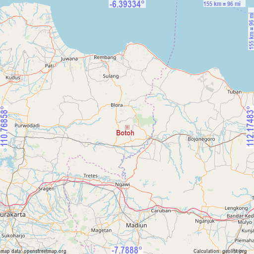
Botoh GPS coordinates[2]
7° 5' 29.76" South, 111° 28' 18.12" East
| Map corner | latitude | longitude |
|---|---|---|
| Upper-left | -6.39334°, | 110.76858° |
| Center: | -7.0916°, | 111.4717° |
| Lower-right: | -7.7888°, | 112.17483° |
| Map W x H: | 155.2×155.2 km | = 96.4×96.4mi |
| max Lat: | 5.88969° ⇑39.4% North |
| Botoh: | -7.0916° |
| min Lat: | ⇓60.6% South -10.934° |
| min Long | Botoh | max Long |
| 95.1345° | 111.4717° | 140.9419° |
| W 41.5%⇐ | ⇒58.5% E |
Elevation
Elevation of Botoh is 86 m = 282 ft, and this is 143.7 m = 471 ft below average elevation for this country.
| Max E: |
3185 m = 10449 ft | 54.8% |
| Avg. | 229.7 m = 754 ft | |
| Botoh | 86 m = 282 ft | |
Min E: |
-1 m = -3 ft | 45.2% |
See also: Indonesia elevation on elevation.city.
Geographical zone
Botoh is located in South Torrid zone (between Equator and Tropic of Capricorn). Distance of Equator is 788.5 km =490 mi to North.| Distance of | km | miles | from Botoh |
|---|---|---|---|
| Equator | 788.5 | 490 | to North |
| Tropic Capricorn | 1817.4 | 1129.3 | to South |
| Antarctic Circle | 6612.7 | 4108.9 | to South |
| South Pole | 9218.5 | 5728.1 | to South |


Nearby cities:
15 places around Botoh: (largest is in red/bold)
• Balangpule
9.5 km =5.9 mi,  160°
160°
• Galuk
2.6 km =1.6 mi,  139°
139°
• Jatiklampok
8.3 km =5.2 mi,  270°
270°
• Jepang Satu
10.2 km =6.3 mi,  327°
327°
• Jomblang
8.9 km =5.5 mi,  336°
336°
• Kedungtuban
8.4 km =5.2 mi, 163°
• Klopoduwur
9.9 km =6.2 mi,  315°
315°
• Ngampon
10.2 km =6.3 mi, 332°
• Ngliron
5.3 km =3.3 mi,  252°
252°
• Ngraho
9.2 km =5.7 mi, 162°
• Nlorong
10.1 km =6.3 mi,  354°
354°
• Palon
9.6 km =6 mi,  9°
9°
• Peting
10 km =6.2 mi,  187°
187°
• Semanggi
6 km =3.7 mi,  306°
306°
• Temanjang
8.7 km =5.4 mi, 268°
Sources, notices
• [Note1] Compared only with cities in Indonesia existing in our database
• [Src1] Map data: © OpenStreetMap contributors (CC-BY-SA)
• [Src2] Other city data from geonames.org with taken over terms of usage.
• [Src3] Geographical zone / Annual Mean Temperature by Robert A. Rohde @ Wikipedia
