Galuk geodata
Galuk (Central Java) is a seat of a fourth-order administrative division; located in Indonesia in Asia/Jakarta (GMT+7) time zone. In our database, there are 407 cities with bigger population. Compared to other cities in Indonesia, 59.7% of cities are located further ↓South; 58.2% of cities are located further →East and 56.5% of cities have higher elevation than Galuk. Note1


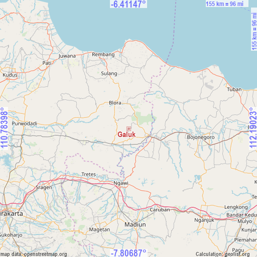
Galuk GPS coordinates[2]
7° 6' 34.92" South, 111° 29' 13.56" East
| Map corner | latitude | longitude |
|---|---|---|
| Upper-left | -6.41147°, | 110.78398° |
| Center: | -7.1097°, | 111.4871° |
| Lower-right: | -7.80687°, | 112.19023° |
| Map W x H: | 155.2×155.2 km | = 96.4×96.4mi |
| max Lat: | 5.88969° ⇑40.3% North |
| Galuk: | -7.1097° |
| min Lat: | ⇓59.7% South -10.934° |
| min Long | Galuk | max Long |
| 95.1345° | 111.4871° | 140.9419° |
| W 41.8%⇐ | ⇒58.2% E |
Elevation
Elevation of Galuk is 76 m = 249 ft, and this is 153.7 m = 504 ft below average elevation for this country.
| Max E: |
3185 m = 10449 ft | 56.5% |
| Avg. | 229.7 m = 754 ft | |
| Galuk | 76 m = 249 ft | |
Min E: |
-1 m = -3 ft | 43.5% |
See also: Indonesia elevation on elevation.city.
Geographical zone
Galuk is located in South Torrid zone (between Equator and Tropic of Capricorn). Distance of Equator is 790.5 km =491.2 mi to North.| Distance of | km | miles | from Galuk |
|---|---|---|---|
| Equator | 790.5 | 491.2 | to North |
| Tropic Capricorn | 1815.4 | 1128 | to South |
| Antarctic Circle | 6610.6 | 4107.6 | to South |
| South Pole | 9216.5 | 5726.9 | to South |


Nearby cities:
15 places around Galuk: (largest is in red/bold)
• Balangpule
7.1 km =4.4 mi,  167°
167°
• Botoh
2.6 km =1.6 mi,  319°
319°
• Jatiklampok
10.2 km =6.3 mi,  281°
281°
• Kedungtuban
6.1 km =3.8 mi, 172°
• Kentongan
10.2 km =6.3 mi,  127°
127°
• Mernung
8.3 km =5.2 mi, 126°
• Mulyorejo
10.1 km =6.3 mi,  122°
122°
• Ngliron
6.7 km =4.2 mi,  273°
273°
• Ngraho
6.9 km =4.3 mi, 170°
• Peting
8.4 km =5.2 mi,  200°
200°
• Pulo
9 km =5.6 mi, 171°
• Semanggi
8.6 km =5.3 mi,  310°
310°
• Seren
7.7 km =4.8 mi, 133°
• Tambakkromo
10.6 km =6.6 mi, 119°
• Tanjung Timur
8.7 km =5.4 mi, 171°
Sources, notices
• [Note1] Compared only with cities in Indonesia existing in our database
• [Src1] Map data: © OpenStreetMap contributors (CC-BY-SA)
• [Src2] Other city data from geonames.org with taken over terms of usage.
• [Src3] Geographical zone / Annual Mean Temperature by Robert A. Rohde @ Wikipedia
