Lingsar geodata
Lingsar (West Nusa Tenggara) is a seat of a fourth-order administrative division; located in Indonesia in Asia/Makassar (GMT+8) time zone. In our database, there are 407 cities with bigger population. Compared to other cities in Indonesia, 86.1% of cities are located further ↑North; 76.3% of cities are located further ←West and 50.8% of cities have lower elevation than Lingsar. Note1


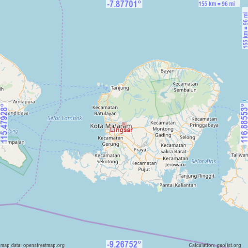
Lingsar GPS coordinates[2]
8° 34' 22.44" South, 116° 10' 56.64" East
| Map corner | latitude | longitude |
|---|---|---|
| Upper-left | -7.87701°, | 115.47928° |
| Center: | -8.5729°, | 116.1824° |
| Lower-right: | -9.26752°, | 116.88553° |
| Map W x H: | 154.6×154.6 km | = 96.1×96.1mi |
| max Lat: | 5.88969° ⇑86.1% North |
| Lingsar: | -8.5729° |
| min Lat: | ⇓13.9% South -10.934° |
| min Long | Lingsar | max Long |
| 95.1345° | 116.1824° | 140.9419° |
| W 76.3%⇐ | ⇒23.7% E |
Elevation
Elevation of Lingsar is 105 m = 344 ft, and this is 124.7 m = 409 ft below average elevation for this country.
| Max E: |
3185 m = 10449 ft | 49.2% |
| Avg. | 229.7 m = 754 ft | |
| Lingsar | 105 m = 344 ft | |
Min E: |
-1 m = -3 ft | 50.8% |
See also: Indonesia elevation on elevation.city.
Geographical zone
Lingsar is located in South Torrid zone (between Equator and Tropic of Capricorn). Distance of Equator is 953.2 km =592.3 mi to North.| Distance of | km | miles | from Lingsar |
|---|---|---|---|
| Equator | 953.2 | 592.3 | to North |
| Tropic Capricorn | 1652.7 | 1026.9 | to South |
| Antarctic Circle | 6448 | 4006.6 | to South |
| South Pole | 9053.8 | 5625.8 | to South |


Nearby cities:
15 places around Lingsar: (largest is in red/bold)
• Babakan Barat
6 km =3.7 mi,  236°
236°
• Batukuta
3.8 km =2.4 mi,  150°
150°
• Bengkel Utara
6.1 km =3.8 mi,  218°
218°
• Dasangeria Selatan
4.2 km =2.6 mi,  296°
296°
• Dumandesa
3.8 km =2.4 mi,  284°
284°
• Jejelok
4.7 km =2.9 mi,  202°
202°
• Narmada
3 km =1.9 mi,  133°
133°
• Penimbung Barat
5.9 km =3.7 mi, 298°
• Sayang Lauq
5.5 km =3.4 mi,  274°
274°
• Selagalas
4.4 km =2.7 mi,  257°
257°
• Selat
3.2 km =2 mi,  107°
107°
• Sindu
5.3 km =3.3 mi, 257°
• Sintung Timur
6 km =3.7 mi, 133°
• Tanakbeak Daye
4.4 km =2.7 mi, 149°
• Tanaktepong
4.1 km =2.5 mi, 128°
Sources, notices
• [Note1] Compared only with cities in Indonesia existing in our database
• [Src1] Map data: © OpenStreetMap contributors (CC-BY-SA)
• [Src2] Other city data from geonames.org with taken over terms of usage.
• [Src3] Geographical zone / Annual Mean Temperature by Robert A. Rohde @ Wikipedia
