Krajan Tengah geodata
Krajan Tengah (East Java) is a seat of a fourth-order administrative division; located in Indonesia in Asia/Jakarta (GMT+7) time zone. In our database, there are 407 cities with bigger population. Compared to other cities in Indonesia, 72.4% of cities are located further ↑North; 59.9% of cities are located further ←West and 58.6% of cities have higher elevation than Krajan Tengah. Note1


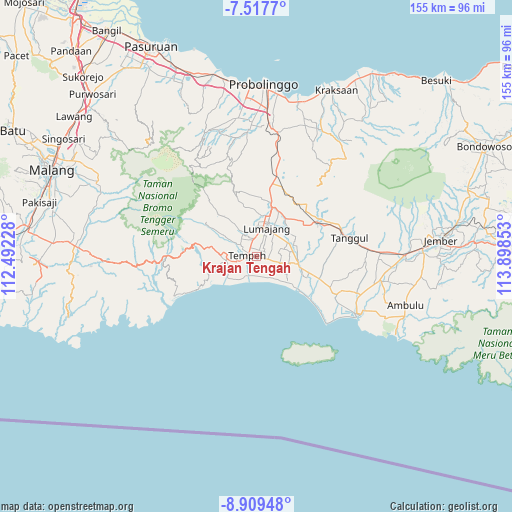
Krajan Tengah GPS coordinates[2]
8° 12' 51.12" South, 113° 11' 43.44" East
| Map corner | latitude | longitude |
|---|---|---|
| Upper-left | -7.5177°, | 112.49228° |
| Center: | -8.2142°, | 113.1954° |
| Lower-right: | -8.90948°, | 113.89853° |
| Map W x H: | 154.8×154.8 km | = 96.2×96.2mi |
| max Lat: | 5.88969° ⇑72.4% North |
| Krajan Tengah: | -8.2142° |
| min Lat: | ⇓27.6% South -10.934° |
| min Long | Krajan Tengah | max Long |
| 95.1345° | 113.1954° | 140.9419° |
| W 59.9%⇐ | ⇒40.1% E |
Elevation
Elevation of Krajan Tengah is 65 m = 213 ft, and this is 164.7 m = 540 ft below average elevation for this country.
| Max E: |
3185 m = 10449 ft | 58.6% |
| Avg. | 229.7 m = 754 ft | |
| Krajan Tengah | 65 m = 213 ft | |
Min E: |
-1 m = -3 ft | 41.4% |
See also: Indonesia elevation on elevation.city.
Geographical zone
Krajan Tengah is located in South Torrid zone (between Equator and Tropic of Capricorn). Distance of Equator is 913.3 km =567.5 mi to North.| Distance of | km | miles | from Krajan Tengah |
|---|---|---|---|
| Equator | 913.3 | 567.5 | to North |
| Tropic Capricorn | 1692.6 | 1051.7 | to South |
| Antarctic Circle | 6487.8 | 4031.3 | to South |
| South Pole | 9093.7 | 5650.6 | to South |


Nearby cities:
15 places around Krajan Tengah: (largest is in red/bold)
• Bedok Dua
3.5 km =2.2 mi,  329°
329°
• Cengkok
2.9 km =1.8 mi,  176°
176°
• Jatiarum
4.4 km =2.7 mi,  138°
138°
• Karangtengah
3.8 km =2.4 mi,  208°
208°
• Kebonan
3.6 km =2.2 mi,  93°
93°
• Kebonsari
2.8 km =1.7 mi,  277°
277°
• Ketangi
3 km =1.9 mi,  109°
109°
• Mentosari
2 km =1.2 mi, 109°
• Mujur Satu
3.6 km =2.2 mi,  261°
261°
• Pandean
2.8 km =1.7 mi,  127°
127°
• Recobanteng
2.9 km =1.8 mi,  53°
53°
• Suko Dua
5.2 km =3.2 mi,  349°
349°
• Sukolilo
4.6 km =2.9 mi,  103°
103°
• Sumberbendo
3.7 km =2.3 mi,  36°
36°
• Tempeh Tengah
2.4 km =1.5 mi,  294°
294°
Sources, notices
• [Note1] Compared only with cities in Indonesia existing in our database
• [Src1] Map data: © OpenStreetMap contributors (CC-BY-SA)
• [Src2] Other city data from geonames.org with taken over terms of usage.
• [Src3] Geographical zone / Annual Mean Temperature by Robert A. Rohde @ Wikipedia
