Loangmaka geodata
Loangmaka (West Nusa Tenggara) is a seat of a fourth-order administrative division; located in Indonesia in Asia/Makassar (GMT+8) time zone. In our database, there are 407 cities with bigger population. Compared to other cities in Indonesia, 89.6% of cities are located further ↑North; 77% of cities are located further ←West and 63.2% of cities have lower elevation than Loangmaka. Note1


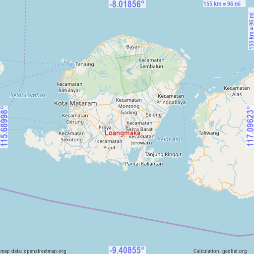
Loangmaka GPS coordinates[2]
8° 42' 51.12" South, 116° 23' 35.16" East
| Map corner | latitude | longitude |
|---|---|---|
| Upper-left | -8.01856°, | 115.68998° |
| Center: | -8.7142°, | 116.3931° |
| Lower-right: | -9.40855°, | 117.09623° |
| Map W x H: | 154.6×154.6 km | = 96.1×96.1mi |
| max Lat: | 5.88969° ⇑89.6% North |
| Loangmaka: | -8.7142° |
| min Lat: | ⇓10.4% South -10.934° |
| min Long | Loangmaka | max Long |
| 95.1345° | 116.3931° | 140.9419° |
| W 77%⇐ | ⇒23% E |
Elevation
Elevation of Loangmaka is 199 m = 653 ft, and this is 30.7 m = 101 ft below average elevation for this country.
| Max E: |
3185 m = 10449 ft | 36.8% |
| Avg. | 229.7 m = 754 ft | |
| Loangmaka | 199 m = 653 ft | |
Min E: |
-1 m = -3 ft | 63.2% |
See also: Indonesia elevation on elevation.city.
Geographical zone
Loangmaka is located in South Torrid zone (between Equator and Tropic of Capricorn). Distance of Equator is 968.9 km =602 mi to North.| Distance of | km | miles | from Loangmaka |
|---|---|---|---|
| Equator | 968.9 | 602 | to North |
| Tropic Capricorn | 1637 | 1017.2 | to South |
| Antarctic Circle | 6432.2 | 3996.8 | to South |
| South Pole | 9038.1 | 5616 | to South |


Nearby cities:
15 places around Loangmaka: (largest is in red/bold)
• Beleka Satu
3.3 km =2.1 mi,  160°
160°
• Beraim
5.9 km =3.7 mi,  277°
277°
• Beson
4.9 km =3 mi,  337°
337°
• Darmaji
7.8 km =4.8 mi,  307°
307°
• Ganti Dua
6.1 km =3.8 mi,  177°
177°
• Gunungrajak
7.7 km =4.8 mi,  83°
83°
• Janapria
2.3 km =1.4 mi,  23°
23°
• Jembe Timur
2 km =1.2 mi,  92°
92°
• Lekor Barat
4.9 km =3 mi,  111°
111°
• Montongtebolak
7.9 km =4.9 mi,  99°
99°
• Mujur
6.8 km =4.2 mi,  218°
218°
• Sengkerang Tiga
6.3 km =3.9 mi,  199°
199°
• Sukarara Utara
5.5 km =3.4 mi, 84°
• Suradi Selatan
7.2 km =4.5 mi, 20°
• Suwangi Utara
6.1 km =3.8 mi,  67°
67°
Sources, notices
• [Note1] Compared only with cities in Indonesia existing in our database
• [Src1] Map data: © OpenStreetMap contributors (CC-BY-SA)
• [Src2] Other city data from geonames.org with taken over terms of usage.
• [Src3] Geographical zone / Annual Mean Temperature by Robert A. Rohde @ Wikipedia
