Pisangkemeng geodata
Pisangkemeng (West Nusa Tenggara) is a seat of a fourth-order administrative division; located in Indonesia in Asia/Makassar (GMT+8) time zone. In our database, there are 407 cities with bigger population. Compared to other cities in Indonesia, 91.5% of cities are located further ↑North; 79.3% of cities are located further ←West and 67.4% of cities have higher elevation than Pisangkemeng. Note1


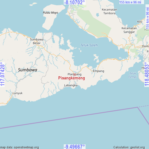
Pisangkemeng GPS coordinates[2]
8° 48' 9" South, 117° 46' 38.64" East
| Map corner | latitude | longitude |
|---|---|---|
| Upper-left | -8.10702°, | 117.07428° |
| Center: | -8.8025°, | 117.7774° |
| Lower-right: | -9.49667°, | 118.48053° |
| Map W x H: | 154.5×154.5 km | = 96×96mi |
| max Lat: | 5.88969° ⇑91.5% North |
| Pisangkemeng: | -8.8025° |
| min Lat: | ⇓8.5% South -10.934° |
| min Long | Pisangkemeng | max Long |
| 95.1345° | 117.7774° | 140.9419° |
| W 79.3%⇐ | ⇒20.7% E |
Elevation
Elevation of Pisangkemeng is 37 m = 121 ft, and this is 192.7 m = 632 ft below average elevation for this country.
| Max E: |
3185 m = 10449 ft | 67.4% |
| Avg. | 229.7 m = 754 ft | |
| Pisangkemeng | 37 m = 121 ft | |
Min E: |
-1 m = -3 ft | 32.6% |
See also: Indonesia elevation on elevation.city.
Geographical zone
Pisangkemeng is located in South Torrid zone (between Equator and Tropic of Capricorn). Distance of Equator is 978.7 km =608.1 mi to North.| Distance of | km | miles | from Pisangkemeng |
|---|---|---|---|
| Equator | 978.7 | 608.1 | to North |
| Tropic Capricorn | 1627.2 | 1011.1 | to South |
| Antarctic Circle | 6422.4 | 3990.7 | to South |
| South Pole | 9028.3 | 5609.9 | to South |


Nearby cities:
15 places around Pisangkemeng: (largest is in red/bold)
• Ampu
26.6 km =16.5 mi,  70°
70°
• Bantu
28.5 km =17.7 mi, 74°
• Boal Atas
20.4 km =12.7 mi,  86°
86°
• Karangtengah
11.6 km =7.2 mi,  198°
198°
• Labangka Satu
10.9 km =6.8 mi,  185°
185°
• Labuhanjambu
29.2 km =18.1 mi, 66°
• Marisgama
15.9 km =9.9 mi,  220°
220°
• Maronge
16.5 km =10.3 mi,  332°
332°
• Mekarjaya
9.6 km =6 mi,  169°
169°
• Muer
7.9 km =4.9 mi,  319°
319°
• Muhajirin
12.9 km =8 mi,  210°
210°
• Parang
23.3 km =14.5 mi, 73°
• Plampang
0.6 km =0.4 mi,  18°
18°
• Simu
17.7 km =11 mi, 327°
• Teluksantong
15.1 km =9.4 mi,  53°
53°
Sources, notices
• [Note1] Compared only with cities in Indonesia existing in our database
• [Src1] Map data: © OpenStreetMap contributors (CC-BY-SA)
• [Src2] Other city data from geonames.org with taken over terms of usage.
• [Src3] Geographical zone / Annual Mean Temperature by Robert A. Rohde @ Wikipedia
