Teluksantong geodata
Teluksantong (West Nusa Tenggara) is a seat of a fourth-order administrative division; located in Indonesia in Asia/Makassar (GMT+8) time zone. In our database, there are 407 cities with bigger population. Compared to other cities in Indonesia, 89.8% of cities are located further ↑North; 79.4% of cities are located further ←West and 92.1% of cities have higher elevation than Teluksantong. Note1


Teluksantong GPS coordinates[2]
8° 43' 18.48" South, 117° 53' 18.24" East
| Map corner | latitude | longitude |
|---|---|---|
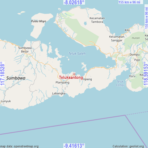
| Upper-left | -8.02618°, | 117.18528° |
| Center: | -8.7218°, | 117.8884° |
| Lower-right: | -9.41613°, | 118.59153° |
| Map W x H: | 154.5×154.6 km | = 96×96.1mi |
| max Lat: | 5.88969° ⇑89.8% North |
| Teluksantong: | -8.7218° |
| min Lat: | ⇓10.2% South -10.934° |
| min Long | Teluksantong | max Long |
| 95.1345° | 117.8884° | 140.9419° |
| W 79.4%⇐ | ⇒20.6% E |
Elevation
Elevation of Teluksantong is 9 m = 30 ft, and this is 220.7 m = 724 ft below average elevation for this country.
| Max E: |
3185 m = 10449 ft | 92.1% |
| Avg. | 229.7 m = 754 ft | |
| Teluksantong | 9 m = 30 ft | |
Min E: |
-1 m = -3 ft | 7.9% |
See also: Indonesia elevation on elevation.city.
Geographical zone
Teluksantong is located in South Torrid zone (between Equator and Tropic of Capricorn). Distance of Equator is 969.8 km =602.6 mi to North.| Distance of | km | miles | from Teluksantong |
|---|---|---|---|
| Equator | 969.8 | 602.6 | to North |
| Tropic Capricorn | 1636.1 | 1016.6 | to South |
| Antarctic Circle | 6431.4 | 3996.3 | to South |
| South Pole | 9037.3 | 5615.5 | to South |


Nearby cities:
15 places around Teluksantong: (largest is in red/bold)
• Ampu
12.9 km =8 mi,  90°
90°
• Bantu
15.3 km =9.5 mi, 94°
• Boal Atas
11.2 km =7 mi,  133°
133°
• Karangtengah
25.6 km =15.9 mi,  218°
218°
• Labangka Satu
23.8 km =14.8 mi,  213°
213°
• Labuhanjambu
14.8 km =9.2 mi,  78°
78°
• Maronge
20.7 km =12.9 mi,  285°
285°
• Mekarjaya
21.2 km =13.2 mi, 209°
• Muer
17.6 km =10.9 mi,  260°
260°
• Muhajirin
27.5 km =17.1 mi, 222°
• Ongko
17.2 km =10.7 mi,  96°
96°
• Parang
10.5 km =6.5 mi, 103°
• Pisangkemeng
15.1 km =9.4 mi,  233°
233°
• Plampang
14.7 km =9.1 mi,  235°
235°
• Simu
22.6 km =14 mi, 285°
Sources, notices
• [Note1] Compared only with cities in Indonesia existing in our database
• [Src1] Map data: © OpenStreetMap contributors (CC-BY-SA)
• [Src2] Other city data from geonames.org with taken over terms of usage.
• [Src3] Geographical zone / Annual Mean Temperature by Robert A. Rohde @ Wikipedia
