Paka geodata
Paka (East Nusa Tenggara) is a seat of a fourth-order administrative division; located in Indonesia in Asia/Makassar (GMT+8) time zone. In our database, there are 407 cities with bigger population. Compared to other cities in Indonesia, 91% of cities are located further ↑North; 84% of cities are located further ←West and 62.3% of cities have lower elevation than Paka. Note1


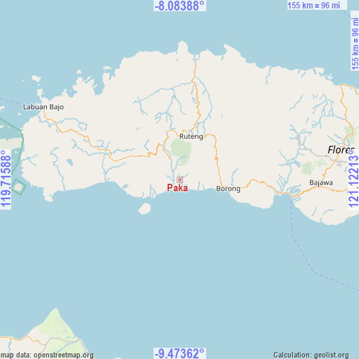
Paka GPS coordinates[2]
8° 46' 45.84" South, 120° 25' 8.4" East
| Map corner | latitude | longitude |
|---|---|---|
| Upper-left | -8.08388°, | 119.71588° |
| Center: | -8.7794°, | 120.419° |
| Lower-right: | -9.47362°, | 121.12213° |
| Map W x H: | 154.5×154.5 km | = 96×96mi |
| max Lat: | 5.88969° ⇑91% North |
| Paka: | -8.7794° |
| min Lat: | ⇓9% South -10.934° |
| min Long | Paka | max Long |
| 95.1345° | 120.419° | 140.9419° |
| W 84%⇐ | ⇒16% E |
Elevation
Elevation of Paka is 188 m = 617 ft, and this is 41.7 m = 137 ft below average elevation for this country.
| Max E: |
3185 m = 10449 ft | 37.7% |
| Avg. | 229.7 m = 754 ft | |
| Paka | 188 m = 617 ft | |
Min E: |
-1 m = -3 ft | 62.3% |
See also: Indonesia elevation on elevation.city.
Geographical zone
Paka is located in South Torrid zone (between Equator and Tropic of Capricorn). Distance of Equator is 976.2 km =606.6 mi to North.| Distance of | km | miles | from Paka |
|---|---|---|---|
| Equator | 976.2 | 606.6 | to North |
| Tropic Capricorn | 1629.7 | 1012.6 | to South |
| Antarctic Circle | 6425 | 3992.3 | to South |
| South Pole | 9030.9 | 5611.5 | to South |


Nearby cities:
15 places around Paka: (largest is in red/bold)
• Benteng
6.8 km =4.2 mi,  232°
232°
• Bombu
14.5 km =9 mi,  47°
47°
• Iteng
3.6 km =2.2 mi,  174°
174°
• Kaca
17.5 km =10.9 mi,  74°
74°
• Kawit
16 km =9.9 mi, 66°
• Keka
8.9 km =5.5 mi,  239°
239°
• Lamba
3.4 km =2.1 mi,  149°
149°
• Narang
5.5 km =3.4 mi,  273°
273°
• Ntaur Satu
15.6 km =9.7 mi, 50°
• Ponggeok
6.3 km =3.9 mi,  355°
355°
• Pongkor
8.1 km =5 mi,  334°
334°
• Pora
8.7 km =5.4 mi, 333°
• Watuweri
5.7 km =3.5 mi,  95°
95°
• Woa
9.1 km =5.7 mi, 102°
• Wongka
13.4 km =8.3 mi,  252°
252°
Sources, notices
• [Note1] Compared only with cities in Indonesia existing in our database
• [Src1] Map data: © OpenStreetMap contributors (CC-BY-SA)
• [Src2] Other city data from geonames.org with taken over terms of usage.
• [Src3] Geographical zone / Annual Mean Temperature by Robert A. Rohde @ Wikipedia
