Gero geodata
Gero (East Nusa Tenggara) is a seat of a fourth-order administrative division; located in Indonesia in Asia/Makassar (GMT+8) time zone. In our database, there are 407 cities with bigger population. Compared to other cities in Indonesia, 89.4% of cities are located further ↑North; 86% of cities are located further ←West and 70.8% of cities have lower elevation than Gero. Note1


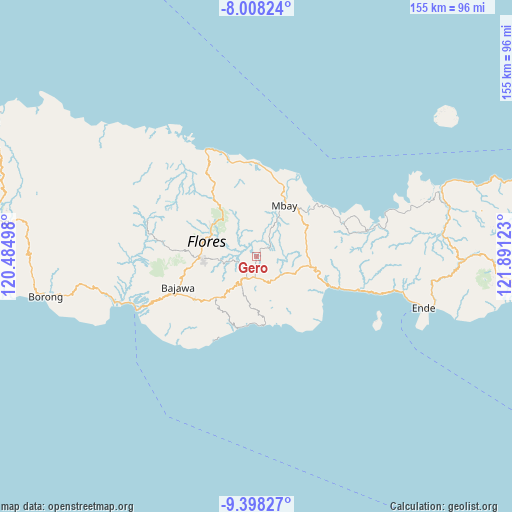
Gero GPS coordinates[2]
8° 42' 14.04" South, 121° 11' 17.16" East
| Map corner | latitude | longitude |
|---|---|---|
| Upper-left | -8.00824°, | 120.48498° |
| Center: | -8.7039°, | 121.1881° |
| Lower-right: | -9.39827°, | 121.89123° |
| Map W x H: | 154.6×154.6 km | = 96.1×96.1mi |
| max Lat: | 5.88969° ⇑89.4% North |
| Gero: | -8.7039° |
| min Lat: | ⇓10.6% South -10.934° |
| min Long | Gero | max Long |
| 95.1345° | 121.1881° | 140.9419° |
| W 86%⇐ | ⇒14% E |
Elevation
Elevation of Gero is 303 m = 994 ft, and this is 73.3 m = 240 ft above average elevation for this country.
| Max E: |
3185 m = 10449 ft | 29.2% |
| Gero | 303 m 994 ft | |
| Avg. | 229.7 m = 754 ft | |
Min E: |
-1 m = -3 ft | 70.8% |
See also: Indonesia elevation on elevation.city.
Geographical zone
Gero is located in South Torrid zone (between Equator and Tropic of Capricorn). Distance of Equator is 967.8 km =601.4 mi to North.| Distance of | km | miles | from Gero |
|---|---|---|---|
| Equator | 967.8 | 601.4 | to North |
| Tropic Capricorn | 1638.1 | 1017.9 | to South |
| Antarctic Circle | 6433.4 | 3997.5 | to South |
| South Pole | 9039.3 | 5616.8 | to South |


Nearby cities:
15 places around Gero: (largest is in red/bold)
• Boawae
7 km =4.3 mi,  197°
197°
• Jawagae
8.9 km =5.5 mi,  143°
143°
• Jawakisa
6.2 km =3.9 mi,  39°
39°
• Jawatiwa
10.2 km =6.3 mi,  92°
92°
• Malapaubhara
9.5 km =5.9 mi,  312°
312°
• Malawona
11.1 km =6.9 mi,  25°
25°
• Nunukae
11.5 km =7.1 mi, 199°
• Padhahegha
9.5 km =5.9 mi,  216°
216°
• Pamakoe
9.2 km =5.7 mi,  132°
132°
• Rega
7.5 km =4.7 mi,  162°
162°
• Tibakisa
6 km =3.7 mi,  189°
189°
• Watugase
3 km =1.9 mi, 185°
• Wologama
10.3 km =6.4 mi, 143°
• Wolonio
9.5 km =5.9 mi, 158°
• Wudu
8 km =5 mi,  167°
167°
Sources, notices
• [Note1] Compared only with cities in Indonesia existing in our database
• [Src1] Map data: © OpenStreetMap contributors (CC-BY-SA)
• [Src2] Other city data from geonames.org with taken over terms of usage.
• [Src3] Geographical zone / Annual Mean Temperature by Robert A. Rohde @ Wikipedia
