Ngondokandawu geodata
Ngondokandawu (East Nusa Tenggara) is a seat of a fourth-order administrative division; located in Indonesia in Asia/Makassar (GMT+8) time zone. In our database, there are 407 cities with bigger population. Compared to other cities in Indonesia, 94.3% of cities are located further ↑North; 81% of cities are located further ←West and 58.6% of cities have lower elevation than Ngondokandawu. Note1


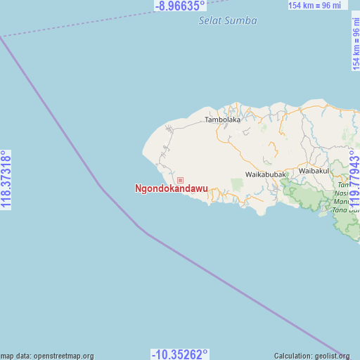
Ngondokandawu GPS coordinates[2]
9° 39' 36.72" South, 119° 4' 34.68" East
| Map corner | latitude | longitude |
|---|---|---|
| Upper-left | -8.96635°, | 118.37318° |
| Center: | -9.6602°, | 119.0763° |
| Lower-right: | -10.35262°, | 119.77943° |
| Map W x H: | 154.1×154.1 km | = 95.8×95.8mi |
| max Lat: | 5.88969° ⇑94.3% North |
| Ngondokandawu: | -9.6602° |
| min Lat: | ⇓5.7% South -10.934° |
| min Long | Ngondokandawu | max Long |
| 95.1345° | 119.0763° | 140.9419° |
| W 81%⇐ | ⇒19% E |
Elevation
Elevation of Ngondokandawu is 151 m = 495 ft, and this is 78.7 m = 258 ft below average elevation for this country.
| Max E: |
3185 m = 10449 ft | 41.4% |
| Avg. | 229.7 m = 754 ft | |
| Ngondokandawu | 151 m = 495 ft | |
Min E: |
-1 m = -3 ft | 58.6% |
See also: Indonesia elevation on elevation.city.
Geographical zone
Ngondokandawu is located in South Torrid zone (between Equator and Tropic of Capricorn). Distance of Equator is 1074.1 km =667.4 mi to North.| Distance of | km | miles | from Ngondokandawu |
|---|---|---|---|
| Equator | 1074.1 | 667.4 | to North |
| Tropic Capricorn | 1531.8 | 951.8 | to South |
| Antarctic Circle | 6327.1 | 3931.5 | to South |
| South Pole | 8932.9 | 5550.6 | to South |


Nearby cities:
15 places around Ngondokandawu: (largest is in red/bold)
• Batang
12.4 km =7.7 mi,  307°
307°
• Bondokodi
11.7 km =7.3 mi, 308°
• Dinjo
10 km =6.2 mi,  316°
316°
• Hamonggolele
12.5 km =7.8 mi, 314°
• Hohawungo
15.4 km =9.6 mi,  338°
338°
• Kahale
5.1 km =3.2 mi,  142°
142°
• Kawangohari
15.5 km =9.6 mi,  328°
328°
• Leteloko
8.8 km =5.5 mi, 314°
• Lokorota
8.2 km =5.1 mi,  351°
351°
• Maliiha
13.5 km =8.4 mi, 332°
• Panenggoede
3 km =1.9 mi,  248°
248°
• Pasolapida
9.8 km =6.1 mi,  76°
76°
• Radamata
14.5 km =9 mi,  31°
31°
• Waiha
4.6 km =2.9 mi, 306°
• Weetombo
11.9 km =7.4 mi, 28°
Sources, notices
• [Note1] Compared only with cities in Indonesia existing in our database
• [Src1] Map data: © OpenStreetMap contributors (CC-BY-SA)
• [Src2] Other city data from geonames.org with taken over terms of usage.
• [Src3] Geographical zone / Annual Mean Temperature by Robert A. Rohde @ Wikipedia
