Ranambeling geodata
Ranambeling (East Nusa Tenggara) is a seat of a fourth-order administrative division; located in Indonesia in Asia/Makassar (GMT+8) time zone. In our database, there are 407 cities with bigger population. Compared to other cities in Indonesia, 88.4% of cities are located further ↑North; 85% of cities are located further ←West and 98.5% of cities have lower elevation than Ranambeling. Note1


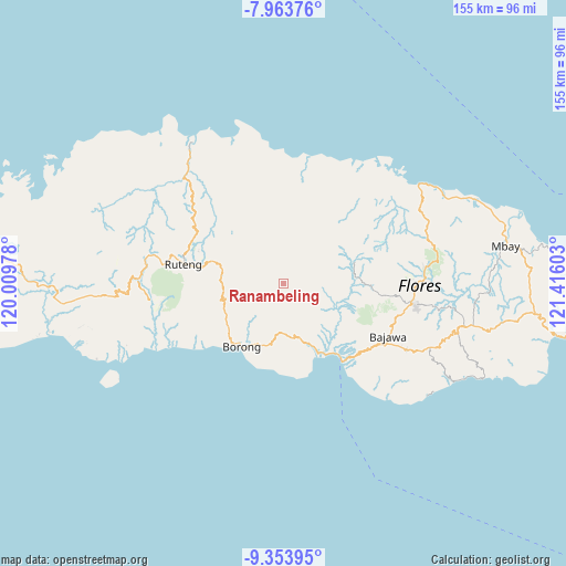
Ranambeling GPS coordinates[2]
8° 39' 34.2" South, 120° 42' 46.44" East
| Map corner | latitude | longitude |
|---|---|---|
| Upper-left | -7.96376°, | 120.00978° |
| Center: | -8.6595°, | 120.7129° |
| Lower-right: | -9.35395°, | 121.41603° |
| Map W x H: | 154.6×154.6 km | = 96.1×96.1mi |
| max Lat: | 5.88969° ⇑88.4% North |
| Ranambeling: | -8.6595° |
| min Lat: | ⇓11.6% South -10.934° |
| min Long | Ranambeling | max Long |
| 95.1345° | 120.7129° | 140.9419° |
| W 85%⇐ | ⇒15% E |
Elevation
Elevation of Ranambeling is 1100 m = 3609 ft, and this is 870.3 m = 2855 ft above average elevation for this country.
| Max E: |
3185 m = 10449 ft | 1.5% |
| Ranambeling | 1100 m 3609 ft | |
| Avg. | 229.7 m = 754 ft | |
Min E: |
-1 m = -3 ft | 98.5% |
See also: Indonesia elevation on elevation.city.
Geographical zone
Ranambeling is located in South Torrid zone (between Equator and Tropic of Capricorn). Distance of Equator is 962.8 km =598.3 mi to North.| Distance of | km | miles | from Ranambeling |
|---|---|---|---|
| Equator | 962.8 | 598.3 | to North |
| Tropic Capricorn | 1643.1 | 1021 | to South |
| Antarctic Circle | 6438.3 | 4000.6 | to South |
| South Pole | 9044.2 | 5619.8 | to South |


Nearby cities:
15 places around Ranambeling: (largest is in red/bold)
• Biting
11.1 km =6.9 mi,  308°
308°
• Dalo
1.8 km =1.1 mi,  270°
270°
• Lete
11.1 km =6.9 mi,  144°
144°
• Lurut
6 km =3.7 mi,  277°
277°
• Mukun
1.9 km =1.2 mi, 275°
• Nggelok
5.5 km =3.4 mi,  77°
77°
• Ngkodal
10.5 km =6.5 mi,  3°
3°
• Ngusu
6.6 km =4.1 mi,  217°
217°
• Pedak
2.5 km =1.6 mi,  239°
239°
• Pejek
1.8 km =1.1 mi,  35°
35°
• Pesek
11.7 km =7.3 mi, 243°
• Tuwa
7.9 km =4.9 mi,  191°
191°
• Waekolong
11.1 km =6.9 mi,  170°
170°
• Waling
8.4 km =5.2 mi, 279°
• Watuka
10.6 km =6.6 mi,  181°
181°
Sources, notices
• [Note1] Compared only with cities in Indonesia existing in our database
• [Src1] Map data: © OpenStreetMap contributors (CC-BY-SA)
• [Src2] Other city data from geonames.org with taken over terms of usage.
• [Src3] Geographical zone / Annual Mean Temperature by Robert A. Rohde @ Wikipedia
