Romba geodata
Romba (East Nusa Tenggara) is a seat of a fourth-order administrative division; located in Indonesia in Asia/Makassar (GMT+8) time zone. In our database, there are 407 cities with bigger population. Compared to other cities in Indonesia, 92.5% of cities are located further ↑North; 86.4% of cities are located further ←West and 76.2% of cities have higher elevation than Romba. Note1


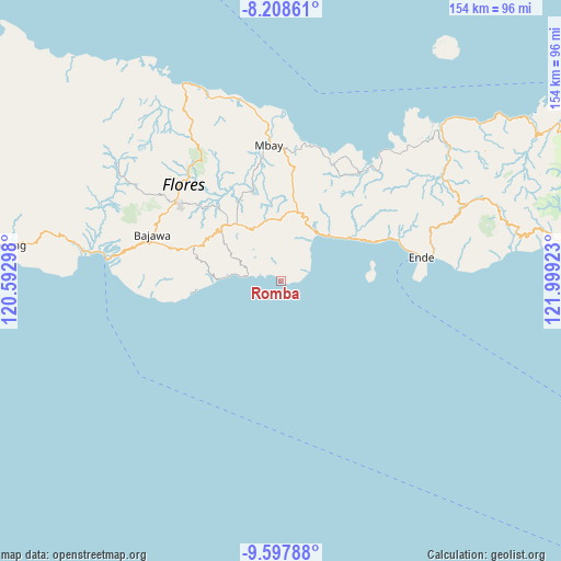
Romba GPS coordinates[2]
8° 54' 14.04" South, 121° 17' 45.96" East
| Map corner | latitude | longitude |
|---|---|---|
| Upper-left | -8.20861°, | 120.59298° |
| Center: | -8.9039°, | 121.2961° |
| Lower-right: | -9.59788°, | 121.99923° |
| Map W x H: | 154.5×154.5 km | = 96×96mi |
| max Lat: | 5.88969° ⇑92.5% North |
| Romba: | -8.9039° |
| min Lat: | ⇓7.5% South -10.934° |
| min Long | Romba | max Long |
| 95.1345° | 121.2961° | 140.9419° |
| W 86.4%⇐ | ⇒13.6% E |
Elevation
Elevation of Romba is 23 m = 75 ft, and this is 206.7 m = 678 ft below average elevation for this country.
| Max E: |
3185 m = 10449 ft | 76.2% |
| Avg. | 229.7 m = 754 ft | |
| Romba | 23 m = 75 ft | |
Min E: |
-1 m = -3 ft | 23.8% |
See also: Indonesia elevation on elevation.city.
Geographical zone
Romba is located in South Torrid zone (between Equator and Tropic of Capricorn). Distance of Equator is 990 km =615.2 mi to North.| Distance of | km | miles | from Romba |
|---|---|---|---|
| Equator | 990 | 615.2 | to North |
| Tropic Capricorn | 1615.9 | 1004.1 | to South |
| Antarctic Circle | 6411.2 | 3983.7 | to South |
| South Pole | 9017 | 5602.9 | to South |


Nearby cities:
15 places around Romba: (largest is in red/bold)
• Bengga
1.6 km =1 mi,  108°
108°
• Bhokadoke
11.5 km =7.1 mi,  8°
8°
• Gelu
10.4 km =6.5 mi,  304°
304°
• Lokatadho
10.2 km =6.3 mi,  346°
346°
• Lokawolo
11.8 km =7.3 mi,  306°
306°
• Maundai
0.8 km =0.5 mi, 307°
• Maunura
7.8 km =4.8 mi,  71°
71°
• Maunuri
2.3 km =1.4 mi, 312°
• Mauponggo
9.5 km =5.9 mi,  279°
279°
• Mbeku
4.3 km =2.7 mi, 345°
• Nasawewe
3 km =1.9 mi,  322°
322°
• Pau
5.4 km =3.4 mi,  3°
3°
• Pusu
9.5 km =5.9 mi,  326°
326°
• Puunage
9.5 km =5.9 mi,  285°
285°
• Wolowada
5.8 km =3.6 mi,  337°
337°
Sources, notices
• [Note1] Compared only with cities in Indonesia existing in our database
• [Src1] Map data: © OpenStreetMap contributors (CC-BY-SA)
• [Src2] Other city data from geonames.org with taken over terms of usage.
• [Src3] Geographical zone / Annual Mean Temperature by Robert A. Rohde @ Wikipedia
