Songgom geodata
Songgom (Banten) is a seat of a fourth-order administrative division; located in Indonesia in Asia/Jakarta (GMT+7) time zone. In our database, there are 407 cities with bigger population. Compared to other cities in Indonesia, 83.3% of cities are located further ↓South; 93.8% of cities are located further →East and 70.2% of cities have higher elevation than Songgom. Note1


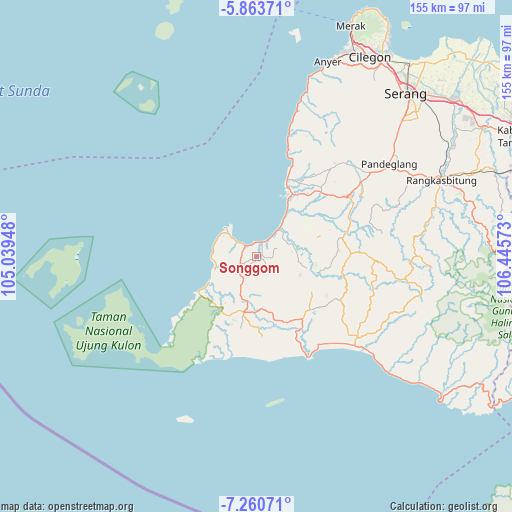
Songgom GPS coordinates[2]
6° 33' 45.72" South, 105° 44' 33.36" East
| Map corner | latitude | longitude |
|---|---|---|
| Upper-left | -5.86371°, | 105.03948° |
| Center: | -6.5627°, | 105.7426° |
| Lower-right: | -7.26071°, | 106.44573° |
| Map W x H: | 155.3×155.3 km | = 96.5×96.5mi |
| max Lat: | 5.88969° ⇑16.7% North |
| Songgom: | -6.5627° |
| min Lat: | ⇓83.3% South -10.934° |
| min Long | Songgom | max Long |
| 95.1345° | 105.7426° | 140.9419° |
| W 6.2%⇐ | ⇒93.8% E |
Elevation
Elevation of Songgom is 32 m = 105 ft, and this is 197.7 m = 649 ft below average elevation for this country.
| Max E: |
3185 m = 10449 ft | 70.2% |
| Avg. | 229.7 m = 754 ft | |
| Songgom | 32 m = 105 ft | |
Min E: |
-1 m = -3 ft | 29.8% |
See also: Indonesia elevation on elevation.city.
Geographical zone
Songgom is located in South Torrid zone (between Equator and Tropic of Capricorn). Distance of Equator is 729.7 km =453.4 mi to North.| Distance of | km | miles | from Songgom |
|---|---|---|---|
| Equator | 729.7 | 453.4 | to North |
| Tropic Capricorn | 1876.2 | 1165.8 | to South |
| Antarctic Circle | 6671.5 | 4145.5 | to South |
| South Pole | 9277.4 | 5764.7 | to South |


Nearby cities:
15 places around Songgom: (largest is in red/bold)
• Babakanbungur
4.7 km =2.9 mi,  282°
282°
• Bojen Kulon
5 km =3.1 mi,  91°
91°
• Cangkeuteuk
6.5 km =4 mi,  127°
127°
• Cigeulis
6.2 km =3.9 mi,  243°
243°
• Ciseukeut Timur
4.6 km =2.9 mi,  17°
17°
• Ciseureuheun
5.1 km =3.2 mi,  216°
216°
• Citeureup
4.8 km =3 mi,  311°
311°
• Marapat
7.3 km =4.5 mi, 223°
• Neglasari
9.4 km =5.8 mi,  36°
36°
• Pangkalan
1.7 km =1.1 mi,  73°
73°
• Perintis
7.7 km =4.8 mi,  59°
59°
• Peusar
8.3 km =5.2 mi,  199°
199°
• Seuseupan
8.7 km =5.4 mi,  77°
77°
• Sobang
1.6 km =1 mi, 88°
• Sumurwaru
7.3 km =4.5 mi,  102°
102°
Sources, notices
• [Note1] Compared only with cities in Indonesia existing in our database
• [Src1] Map data: © OpenStreetMap contributors (CC-BY-SA)
• [Src2] Other city data from geonames.org with taken over terms of usage.
• [Src3] Geographical zone / Annual Mean Temperature by Robert A. Rohde @ Wikipedia
