Babakantonggoh geodata
Babakantonggoh (Banten) is a seat of a fourth-order administrative division; located in Indonesia in Asia/Jakarta (GMT+7) time zone. In our database, there are 407 cities with bigger population. Compared to other cities in Indonesia, 81% of cities are located further ↓South; 94.2% of cities are located further →East and 57.3% of cities have lower elevation than Babakantonggoh. Note1


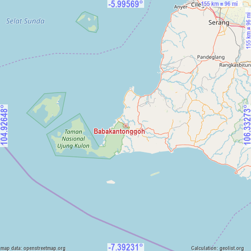
Babakantonggoh GPS coordinates[2]
6° 41' 40.2" South, 105° 37' 46.56" East
| Map corner | latitude | longitude |
|---|---|---|
| Upper-left | -5.99569°, | 104.92648° |
| Center: | -6.6945°, | 105.6296° |
| Lower-right: | -7.39231°, | 106.33273° |
| Map W x H: | 155.3×155.3 km | = 96.5×96.5mi |
| max Lat: | 5.88969° ⇑19% North |
| Babakantonggoh: | -6.6945° |
| min Lat: | ⇓81% South -10.934° |
| min Long | Babakantonggoh | max Long |
| 95.1345° | 105.6296° | 140.9419° |
| W 5.8%⇐ | ⇒94.2% E |
Elevation
Elevation of Babakantonggoh is 139 m = 456 ft, and this is 90.7 m = 298 ft below average elevation for this country.
| Max E: |
3185 m = 10449 ft | 42.7% |
| Avg. | 229.7 m = 754 ft | |
| Babakantonggoh | 139 m = 456 ft | |
Min E: |
-1 m = -3 ft | 57.3% |
See also: Indonesia elevation on elevation.city.
Geographical zone
Babakantonggoh is located in South Torrid zone (between Equator and Tropic of Capricorn). Distance of Equator is 744.4 km =462.5 mi to North.| Distance of | km | miles | from Babakantonggoh |
|---|---|---|---|
| Equator | 744.4 | 462.5 | to North |
| Tropic Capricorn | 1861.6 | 1156.7 | to South |
| Antarctic Circle | 6656.8 | 4136.3 | to South |
| South Pole | 9262.7 | 5755.6 | to South |


Nearby cities:
15 places around Babakantonggoh: (largest is in red/bold)
• Babakantengah
9.5 km =5.9 mi,  52°
52°
• Cangkeuteuk Sabrang
3.6 km =2.2 mi,  186°
186°
• Cibaliung
9.6 km =6 mi,  96°
96°
• Ciburial
5.2 km =3.2 mi,  128°
128°
• Cijalarang
5.6 km =3.5 mi, 53°
• Cikadondongdesa
8.5 km =5.3 mi,  63°
63°
• Cikadu
9.7 km =6 mi, 125°
• Ciunil Barat
3.8 km =2.4 mi,  94°
94°
• Gunungkendeng
8.4 km =5.2 mi,  78°
78°
• Karangbolong
7.6 km =4.7 mi,  17°
17°
• Pematangluhur
8.7 km =5.4 mi,  167°
167°
• Polos
2.3 km =1.4 mi,  105°
105°
• Rancasadang
8.8 km =5.5 mi,  140°
140°
• Salam
9.7 km =6 mi, 87°
• Sukajadi
8.7 km =5.4 mi, 104°
Sources, notices
• [Note1] Compared only with cities in Indonesia existing in our database
• [Src1] Map data: © OpenStreetMap contributors (CC-BY-SA)
• [Src2] Other city data from geonames.org with taken over terms of usage.
• [Src3] Geographical zone / Annual Mean Temperature by Robert A. Rohde @ Wikipedia
