Pasirloa geodata
Pasirloa (Banten) is a seat of a fourth-order administrative division; located in Indonesia in Asia/Jakarta (GMT+7) time zone. In our database, there are 407 cities with bigger population. Compared to other cities in Indonesia, 83.7% of cities are located further ↓South; 92.6% of cities are located further →East and 83% of cities have higher elevation than Pasirloa. Note1


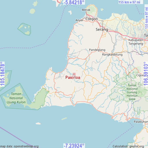
Pasirloa GPS coordinates[2]
6° 32' 28.32" South, 105° 53' 16.44" East
| Map corner | latitude | longitude |
|---|---|---|
| Upper-left | -5.84218°, | 105.18478° |
| Center: | -6.5412°, | 105.8879° |
| Lower-right: | -7.23924°, | 106.59103° |
| Map W x H: | 155.3×155.3 km | = 96.5×96.5mi |
| max Lat: | 5.88969° ⇑16.3% North |
| Pasirloa: | -6.5412° |
| min Lat: | ⇓83.7% South -10.934° |
| min Long | Pasirloa | max Long |
| 95.1345° | 105.8879° | 140.9419° |
| W 7.4%⇐ | ⇒92.6% E |
Elevation
Elevation of Pasirloa is 16 m = 52 ft, and this is 213.7 m = 701 ft below average elevation for this country.
| Max E: |
3185 m = 10449 ft | 83% |
| Avg. | 229.7 m = 754 ft | |
| Pasirloa | 16 m = 52 ft | |
Min E: |
-1 m = -3 ft | 17% |
See also: Indonesia elevation on elevation.city.
Geographical zone
Pasirloa is located in South Torrid zone (between Equator and Tropic of Capricorn). Distance of Equator is 727.3 km =451.9 mi to North.| Distance of | km | miles | from Pasirloa |
|---|---|---|---|
| Equator | 727.3 | 451.9 | to North |
| Tropic Capricorn | 1878.6 | 1167.3 | to South |
| Antarctic Circle | 6673.9 | 4147 | to South |
| South Pole | 9279.7 | 5766.1 | to South |


Nearby cities:
15 places around Pasirloa: (largest is in red/bold)
• Awilega
5.2 km =3.2 mi,  237°
237°
• Campaka
3.6 km =2.2 mi,  95°
95°
• Cikayas
5.8 km =3.6 mi,  188°
188°
• Jambubol
1.8 km =1.1 mi,  250°
250°
• Kadumelati
5.4 km =3.4 mi,  42°
42°
• Kalapadua
4.4 km =2.7 mi, 235°
• Kampungbaru
1.6 km =1 mi,  56°
56°
• Kampungmasjid
2.8 km =1.7 mi,  172°
172°
• Langkapcaang Hilir
4 km =2.5 mi, 101°
• Pasarbaru
5.9 km =3.7 mi,  67°
67°
• Pasirgadung Satu
5.6 km =3.5 mi,  13°
13°
• Pasirkadu
4.8 km =3 mi,  306°
306°
• Perdana
5.5 km =3.4 mi,  285°
285°
• Rancahideung
4.4 km =2.7 mi,  268°
268°
• Turus
3.9 km =2.4 mi,  349°
349°
Sources, notices
• [Note1] Compared only with cities in Indonesia existing in our database
• [Src1] Map data: © OpenStreetMap contributors (CC-BY-SA)
• [Src2] Other city data from geonames.org with taken over terms of usage.
• [Src3] Geographical zone / Annual Mean Temperature by Robert A. Rohde @ Wikipedia
