Sukamaju geodata
Sukamaju (Banten) is a seat of a fourth-order administrative division; located in Indonesia in Asia/Jakarta (GMT+7) time zone. In our database, there are 407 cities with bigger population. Compared to other cities in Indonesia, 77.4% of cities are located further ↓South; 90.2% of cities are located further →East and 60.7% of cities have lower elevation than Sukamaju. Note1


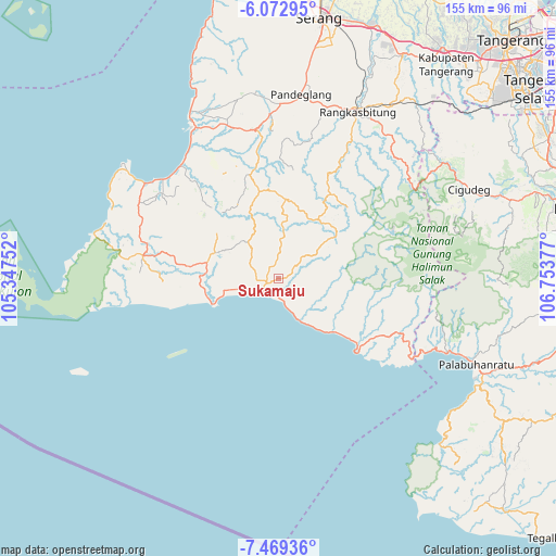
Sukamaju GPS coordinates[2]
6° 46' 17.976" South, 106° 3' 2.304" East
| Map corner | latitude | longitude |
|---|---|---|
| Upper-left | -6.07295°, | 105.34752° |
| Center: | -6.77166°, | 106.05064° |
| Lower-right: | -7.46936°, | 106.75377° |
| Map W x H: | 155.3×155.3 km | = 96.5×96.5mi |
| max Lat: | 5.88969° ⇑22.6% North |
| Sukamaju: | -6.77166° |
| min Lat: | ⇓77.4% South -10.934° |
| min Long | Sukamaju | max Long |
| 95.1345° | 106.05064° | 140.9419° |
| W 9.8%⇐ | ⇒90.2% E |
Elevation
Elevation of Sukamaju is 172 m = 564 ft, and this is 57.7 m = 189 ft below average elevation for this country.
| Max E: |
3185 m = 10449 ft | 39.3% |
| Avg. | 229.7 m = 754 ft | |
| Sukamaju | 172 m = 564 ft | |
Min E: |
-1 m = -3 ft | 60.7% |
See also: Indonesia elevation on elevation.city.
Geographical zone
Sukamaju is located in South Torrid zone (between Equator and Tropic of Capricorn). Distance of Equator is 752.9 km =467.8 mi to North.| Distance of | km | miles | from Sukamaju |
|---|---|---|---|
| Equator | 752.9 | 467.8 | to North |
| Tropic Capricorn | 1853 | 1151.4 | to South |
| Antarctic Circle | 6648.2 | 4131 | to South |
| South Pole | 9254.1 | 5750.2 | to South |


Nearby cities:
15 places around Sukamaju: (largest is in red/bold)
• Bolang
6.4 km =4 mi,  275°
275°
• Ciapus
4.9 km =3 mi,  54°
54°
• Cikadu
5.2 km =3.2 mi,  110°
110°
• Citaritih
5.8 km =3.6 mi,  177°
177°
• Citeureup
5.3 km =3.3 mi,  271°
271°
• Jatiraya
5.5 km =3.4 mi,  221°
221°
• Kadujajar
3.8 km =2.4 mi,  313°
313°
• Kandang Timur
6.1 km =3.8 mi,  233°
233°
• Kandangsapi
4 km =2.5 mi,  323°
323°
• Malingping
3.7 km =2.3 mi,  258°
258°
• Pagelaran
5 km =3.1 mi,  193°
193°
• Pasirgeleng
5.4 km =3.4 mi, 230°
• Pasirhaur
3.8 km =2.4 mi, 261°
• Sanghiang
5.4 km =3.4 mi, 278°
• Sukaraja
3.3 km =2.1 mi,  239°
239°
Sources, notices
• [Note1] Compared only with cities in Indonesia existing in our database
• [Src1] Map data: © OpenStreetMap contributors (CC-BY-SA)
• [Src2] Other city data from geonames.org with taken over terms of usage.
• [Src3] Geographical zone / Annual Mean Temperature by Robert A. Rohde @ Wikipedia
