Sumandang geodata
Sumandang (Banten) is a seat of a third-order administrative division; located in Indonesia in Asia/Jakarta (GMT+7) time zone. In our database, there are 407 cities with bigger population. Compared to other cities in Indonesia, 84.3% of cities are located further ↓South; 88.3% of cities are located further →East and 51.3% of cities have lower elevation than Sumandang. Note1


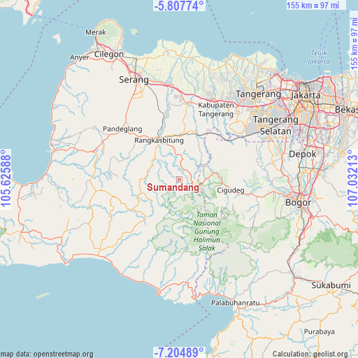
Sumandang GPS coordinates[2]
6° 30' 24.48" South, 106° 19' 44.4" East
| Map corner | latitude | longitude |
|---|---|---|
| Upper-left | -5.80774°, | 105.62588° |
| Center: | -6.5068°, | 106.329° |
| Lower-right: | -7.20489°, | 107.03213° |
| Map W x H: | 155.3×155.4 km | = 96.5×96.6mi |
| max Lat: | 5.88969° ⇑15.7% North |
| Sumandang: | -6.5068° |
| min Lat: | ⇓84.3% South -10.934° |
| min Long | Sumandang | max Long |
| 95.1345° | 106.329° | 140.9419° |
| W 11.7%⇐ | ⇒88.3% E |
Elevation
Elevation of Sumandang is 107 m = 351 ft, and this is 122.7 m = 403 ft below average elevation for this country.
| Max E: |
3185 m = 10449 ft | 48.7% |
| Avg. | 229.7 m = 754 ft | |
| Sumandang | 107 m = 351 ft | |
Min E: |
-1 m = -3 ft | 51.3% |
See also: Indonesia elevation on elevation.city.
Geographical zone
Sumandang is located in South Torrid zone (between Equator and Tropic of Capricorn). Distance of Equator is 723.5 km =449.6 mi to North.| Distance of | km | miles | from Sumandang |
|---|---|---|---|
| Equator | 723.5 | 449.6 | to North |
| Tropic Capricorn | 1882.4 | 1169.7 | to South |
| Antarctic Circle | 6677.7 | 4149.3 | to South |
| South Pole | 9283.6 | 5768.6 | to South |


Nearby cities:
15 places around Sumandang: (largest is in red/bold)
• Cibeurih
4.6 km =2.9 mi,  180°
180°
• Cimarkum
6.6 km =4.1 mi,  161°
161°
• Ciminyak
5.5 km =3.4 mi,  221°
221°
• Cipunglu
6.7 km =4.2 mi, 180°
• Cirangrang
5.4 km =3.4 mi,  228°
228°
• Gajrug
6 km =3.7 mi,  111°
111°
• Guradog
7 km =4.3 mi,  89°
89°
• Kadubitung
4.3 km =2.7 mi,  141°
141°
• Leuwisema
5.5 km =3.4 mi, 114°
• Lurah
6.9 km =4.3 mi,  115°
115°
• Malangnengah
4.2 km =2.6 mi,  126°
126°
• Muncang
5.9 km =3.7 mi, 225°
• Neglasari
4.2 km =2.6 mi,  247°
247°
• Puputan
6.7 km =4.2 mi,  148°
148°
• Sukaraja
3.7 km =2.3 mi,  209°
209°
Sources, notices
• [Note1] Compared only with cities in Indonesia existing in our database
• [Src1] Map data: © OpenStreetMap contributors (CC-BY-SA)
• [Src2] Other city data from geonames.org with taken over terms of usage.
• [Src3] Geographical zone / Annual Mean Temperature by Robert A. Rohde @ Wikipedia
