Gunungsulah geodata
Gunungsulah (West Java) is a seat of a fourth-order administrative division; located in Indonesia in Asia/Jakarta (GMT+7) time zone. In our database, there are 407 cities with bigger population. Compared to other cities in Indonesia, 58.2% of cities are located further ↑North; 83.6% of cities are located further →East and 90.6% of cities have higher elevation than Gunungsulah. Note1


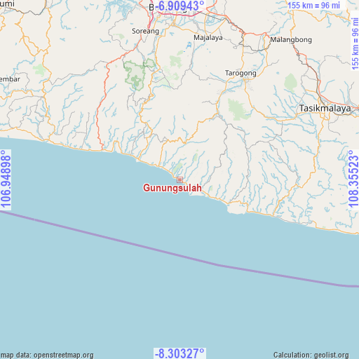
Gunungsulah GPS coordinates[2]
7° 36' 24.912" South, 107° 39' 7.56" East
| Map corner | latitude | longitude |
|---|---|---|
| Upper-left | -6.90943°, | 106.94898° |
| Center: | -7.60692°, | 107.6521° |
| Lower-right: | -8.30327°, | 108.35523° |
| Map W x H: | 155×155 km | = 96.3×96.3mi |
| max Lat: | 5.88969° ⇑58.2% North |
| Gunungsulah: | -7.60692° |
| min Lat: | ⇓41.8% South -10.934° |
| min Long | Gunungsulah | max Long |
| 95.1345° | 107.6521° | 140.9419° |
| W 16.4%⇐ | ⇒83.6% E |
Elevation
Elevation of Gunungsulah is 10 m = 33 ft, and this is 219.7 m = 721 ft below average elevation for this country.
| Max E: |
3185 m = 10449 ft | 90.6% |
| Avg. | 229.7 m = 754 ft | |
| Gunungsulah | 10 m = 33 ft | |
Min E: |
-1 m = -3 ft | 9.4% |
See also: Indonesia elevation on elevation.city.
Geographical zone
Gunungsulah is located in South Torrid zone (between Equator and Tropic of Capricorn). Distance of Equator is 845.8 km =525.6 mi to North.| Distance of | km | miles | from Gunungsulah |
|---|---|---|---|
| Equator | 845.8 | 525.6 | to North |
| Tropic Capricorn | 1760.1 | 1093.7 | to South |
| Antarctic Circle | 6555.4 | 4073.3 | to South |
| South Pole | 9161.3 | 5692.6 | to South |


Nearby cities:
15 places around Gunungsulah: (largest is in red/bold)
• Babakan
7.3 km =4.5 mi,  116°
116°
• Bojong
9.3 km =5.8 mi,  82°
82°
• Bokor
10.1 km =6.3 mi,  334°
334°
• Bunisari
8 km =5 mi, 124°
• Burujul
9.2 km =5.7 mi,  51°
51°
• Cibitung
8.8 km =5.5 mi,  25°
25°
• Cijambe
2.5 km =1.6 mi,  104°
104°
• Cikelet
2.8 km =1.7 mi, 100°
• Citeureup
6.7 km =4.2 mi,  114°
114°
• Karangsari
5.1 km =3.2 mi,  312°
312°
• Lembur Tengah
9.5 km =5.9 mi, 118°
• Nangoh
8.8 km =5.5 mi, 117°
• Paas Girang
10.9 km =6.8 mi, 115°
• Pameungpeuk
9.7 km =6 mi, 113°
• Puncaksari
9.6 km =6 mi, 112°
Sources, notices
• [Note1] Compared only with cities in Indonesia existing in our database
• [Src1] Map data: © OpenStreetMap contributors (CC-BY-SA)
• [Src2] Other city data from geonames.org with taken over terms of usage.
• [Src3] Geographical zone / Annual Mean Temperature by Robert A. Rohde @ Wikipedia
