Leuwidahu geodata
Leuwidahu (West Java) is a seat of a fourth-order administrative division; located in Indonesia in Asia/Jakarta (GMT+7) time zone. In our database, there are 407 cities with bigger population. Compared to other cities in Indonesia, 51% of cities are located further ↓South; 76.1% of cities are located further →East and 76.4% of cities have lower elevation than Leuwidahu. Note1


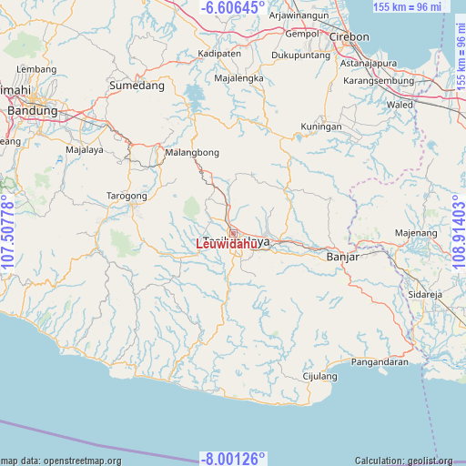
Leuwidahu GPS coordinates[2]
7° 18' 15.84" South, 108° 12' 39.24" East
| Map corner | latitude | longitude |
|---|---|---|
| Upper-left | -6.60645°, | 107.50778° |
| Center: | -7.3044°, | 108.2109° |
| Lower-right: | -8.00126°, | 108.91403° |
| Map W x H: | 155.1×155.1 km | = 96.4×96.4mi |
| max Lat: | 5.88969° ⇑49% North |
| Leuwidahu: | -7.3044° |
| min Lat: | ⇓51% South -10.934° |
| min Long | Leuwidahu | max Long |
| 95.1345° | 108.2109° | 140.9419° |
| W 23.9%⇐ | ⇒76.1% E |
Elevation
Elevation of Leuwidahu is 378 m = 1240 ft, and this is 148.3 m = 487 ft above average elevation for this country.
| Max E: |
3185 m = 10449 ft | 23.6% |
| Leuwidahu | 378 m 1240 ft | |
| Avg. | 229.7 m = 754 ft | |
Min E: |
-1 m = -3 ft | 76.4% |
See also: Indonesia elevation on elevation.city.
Geographical zone
Leuwidahu is located in South Torrid zone (between Equator and Tropic of Capricorn). Distance of Equator is 812.2 km =504.7 mi to North.| Distance of | km | miles | from Leuwidahu |
|---|---|---|---|
| Equator | 812.2 | 504.7 | to North |
| Tropic Capricorn | 1793.7 | 1114.6 | to South |
| Antarctic Circle | 6589 | 4094.2 | to South |
| South Pole | 9194.9 | 5713.4 | to South |


Nearby cities:
15 places around Leuwidahu: (largest is in red/bold)
• Ampera
2 km =1.2 mi,  180°
180°
• Argasari
2.3 km =1.4 mi,  194°
194°
• Cibogor
2.4 km =1.5 mi,  117°
117°
• Desa Kaler Gunungcupu
2.3 km =1.4 mi,  62°
62°
• Gunungbatu
1.1 km =0.7 mi,  223°
223°
• Gunungkoneng
2.7 km =1.7 mi, 180°
• Jati
0.8 km =0.5 mi,  275°
275°
• Kosangka
1.5 km =0.9 mi,  338°
338°
• Mancogeh
0.8 km =0.5 mi, 124°
• Nagarasari
1.2 km =0.7 mi,  68°
68°
• Pakemitan
1.8 km =1.1 mi,  317°
317°
• Rajapeni
2.3 km =1.4 mi,  10°
10°
• Sindangpalay
2.2 km =1.4 mi, 320°
• Sukamulya
2.3 km =1.4 mi,  239°
239°
• Tawangsari
2.3 km =1.4 mi,  152°
152°
Sources, notices
• [Note1] Compared only with cities in Indonesia existing in our database
• [Src1] Map data: © OpenStreetMap contributors (CC-BY-SA)
• [Src2] Other city data from geonames.org with taken over terms of usage.
• [Src3] Geographical zone / Annual Mean Temperature by Robert A. Rohde @ Wikipedia
