Sagalaherang geodata
Sagalaherang (West Java) is a seat of a fourth-order administrative division; located in Indonesia in Asia/Jakarta (GMT+7) time zone. In our database, there are 407 cities with bigger population. Compared to other cities in Indonesia, 59% of cities are located further ↓South; 73% of cities are located further →East and 89.2% of cities have lower elevation than Sagalaherang. Note1


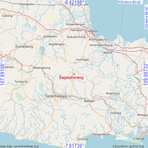
Sagalaherang GPS coordinates[2]
7° 7' 12.72" South, 108° 23' 39.12" East
| Map corner | latitude | longitude |
|---|---|---|
| Upper-left | -6.42198°, | 107.69108° |
| Center: | -7.1202°, | 108.3942° |
| Lower-right: | -7.81736°, | 109.09733° |
| Map W x H: | 155.2×155.2 km | = 96.4×96.4mi |
| max Lat: | 5.88969° ⇑41% North |
| Sagalaherang: | -7.1202° |
| min Lat: | ⇓59% South -10.934° |
| min Long | Sagalaherang | max Long |
| 95.1345° | 108.3942° | 140.9419° |
| W 27%⇐ | ⇒73% E |
Elevation
Elevation of Sagalaherang is 614 m = 2014 ft, and this is 384.3 m = 1261 ft above average elevation for this country.
| Max E: |
3185 m = 10449 ft | 10.8% |
| Sagalaherang | 614 m 2014 ft | |
| Avg. | 229.7 m = 754 ft | |
Min E: |
-1 m = -3 ft | 89.2% |
See also: Indonesia elevation on elevation.city.
Geographical zone
Sagalaherang is located in South Torrid zone (between Equator and Tropic of Capricorn). Distance of Equator is 791.7 km =491.9 mi to North.| Distance of | km | miles | from Sagalaherang |
|---|---|---|---|
| Equator | 791.7 | 491.9 | to North |
| Tropic Capricorn | 1814.2 | 1127.3 | to South |
| Antarctic Circle | 6609.5 | 4107 | to South |
| South Pole | 9215.4 | 5726.2 | to South |


Nearby cities:
15 places around Sagalaherang: (largest is in red/bold)
• Bojong
4.7 km =2.9 mi,  84°
84°
• Cantilan
5.2 km =3.2 mi,  70°
70°
• Cibeuruy
5.2 km =3.2 mi,  127°
127°
• Cicadas
4.9 km =3 mi,  145°
145°
• Cimenga
4.1 km =2.5 mi,  12°
12°
• Cinyasag
4 km =2.5 mi,  324°
324°
• Emblegan
3.3 km =2.1 mi,  114°
114°
• Gardu
5 km =3.1 mi,  347°
347°
• Jagabaya Dua
1.7 km =1.1 mi,  1°
1°
• Kaom
2.7 km =1.7 mi, 113°
• Legok Satu
3.9 km =2.4 mi,  286°
286°
• Madura
3.5 km =2.2 mi,  208°
208°
• Panawangan
1.4 km =0.9 mi,  279°
279°
• Pasiramis
5.1 km =3.2 mi,  174°
174°
• Singgugu
4.9 km =3 mi,  243°
243°
Sources, notices
• [Note1] Compared only with cities in Indonesia existing in our database
• [Src1] Map data: © OpenStreetMap contributors (CC-BY-SA)
• [Src2] Other city data from geonames.org with taken over terms of usage.
• [Src3] Geographical zone / Annual Mean Temperature by Robert A. Rohde @ Wikipedia
