Banggi geodata
Banggi (Central Java) is a seat of a fourth-order administrative division; located in Indonesia in Asia/Jakarta (GMT+7) time zone. In our database, there are 407 cities with bigger population. Compared to other cities in Indonesia, 78.4% of cities are located further ↓South; 61.8% of cities are located further →East and 72.7% of cities have higher elevation than Banggi. Note1


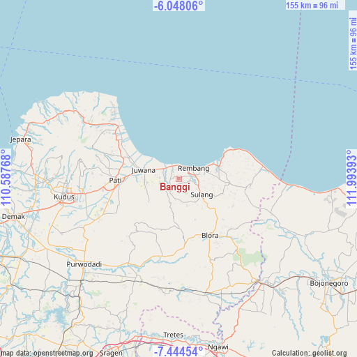
Banggi GPS coordinates[2]
6° 44' 48.48" South, 111° 17' 26.88" East
| Map corner | latitude | longitude |
|---|---|---|
| Upper-left | -6.04806°, | 110.58768° |
| Center: | -6.7468°, | 111.2908° |
| Lower-right: | -7.44454°, | 111.99393° |
| Map W x H: | 155.3×155.3 km | = 96.5×96.5mi |
| max Lat: | 5.88969° ⇑21.6% North |
| Banggi: | -6.7468° |
| min Lat: | ⇓78.4% South -10.934° |
| min Long | Banggi | max Long |
| 95.1345° | 111.2908° | 140.9419° |
| W 38.2%⇐ | ⇒61.8% E |
Elevation
Elevation of Banggi is 28 m = 92 ft, and this is 201.7 m = 662 ft below average elevation for this country.
| Max E: |
3185 m = 10449 ft | 72.7% |
| Avg. | 229.7 m = 754 ft | |
| Banggi | 28 m = 92 ft | |
Min E: |
-1 m = -3 ft | 27.3% |
See also: Indonesia elevation on elevation.city.
Geographical zone
Banggi is located in South Torrid zone (between Equator and Tropic of Capricorn). Distance of Equator is 750.2 km =466.2 mi to North.| Distance of | km | miles | from Banggi |
|---|---|---|---|
| Equator | 750.2 | 466.2 | to North |
| Tropic Capricorn | 1855.7 | 1153.1 | to South |
| Antarctic Circle | 6651 | 4132.7 | to South |
| South Pole | 9256.9 | 5752 | to South |


Nearby cities:
15 places around Banggi: (largest is in red/bold)
• Babadan
2.8 km =1.7 mi,  9°
9°
• Bulak
3.2 km =2 mi,  162°
162°
• Gingsir
2.5 km =1.6 mi,  282°
282°
• Grawan
2.3 km =1.4 mi,  179°
179°
• Jadi
4 km =2.5 mi,  211°
211°
• Karangsekar
4 km =2.5 mi, 7°
• Kuangsan
0.9 km =0.6 mi,  83°
83°
• Legok
3 km =1.9 mi,  122°
122°
• Megulung
3.9 km =2.4 mi,  223°
223°
• Mojogajeh
2.4 km =1.5 mi, 219°
• Pengkol
1.4 km =0.9 mi, 6°
• Pentil
1.9 km =1.2 mi,  101°
101°
• Sambiyan
2.9 km =1.8 mi,  306°
306°
• Tlogotunggal
1.3 km =0.8 mi,  148°
148°
• Trambalan
4 km =2.5 mi,  111°
111°
Sources, notices
• [Note1] Compared only with cities in Indonesia existing in our database
• [Src1] Map data: © OpenStreetMap contributors (CC-BY-SA)
• [Src2] Other city data from geonames.org with taken over terms of usage.
• [Src3] Geographical zone / Annual Mean Temperature by Robert A. Rohde @ Wikipedia
