Bogorame geodata
Bogorame (Central Java) is a seat of a fourth-order administrative division; located in Indonesia in Asia/Jakarta (GMT+7) time zone. In our database, there are 407 cities with bigger population. Compared to other cities in Indonesia, 77.6% of cities are located further ↓South; 60.9% of cities are located further →East and 66.4% of cities have higher elevation than Bogorame. Note1


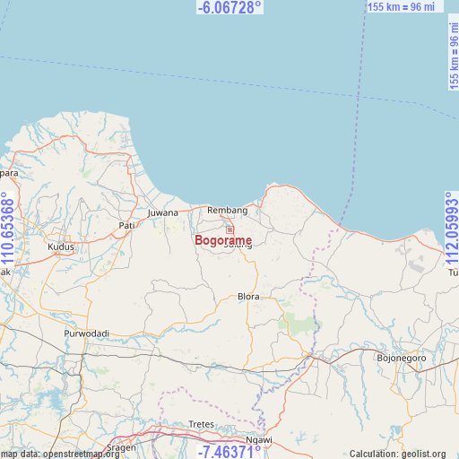
Bogorame GPS coordinates[2]
6° 45' 57.6" South, 111° 21' 24.48" East
| Map corner | latitude | longitude |
|---|---|---|
| Upper-left | -6.06728°, | 110.65368° |
| Center: | -6.766°, | 111.3568° |
| Lower-right: | -7.46371°, | 112.05993° |
| Map W x H: | 155.3×155.3 km | = 96.5×96.5mi |
| max Lat: | 5.88969° ⇑22.4% North |
| Bogorame: | -6.766° |
| min Lat: | ⇓77.6% South -10.934° |
| min Long | Bogorame | max Long |
| 95.1345° | 111.3568° | 140.9419° |
| W 39.1%⇐ | ⇒60.9% E |
Elevation
Elevation of Bogorame is 39 m = 128 ft, and this is 190.7 m = 626 ft below average elevation for this country.
| Max E: |
3185 m = 10449 ft | 66.4% |
| Avg. | 229.7 m = 754 ft | |
| Bogorame | 39 m = 128 ft | |
Min E: |
-1 m = -3 ft | 33.6% |
See also: Indonesia elevation on elevation.city.
Geographical zone
Bogorame is located in South Torrid zone (between Equator and Tropic of Capricorn). Distance of Equator is 752.3 km =467.5 mi to North.| Distance of | km | miles | from Bogorame |
|---|---|---|---|
| Equator | 752.3 | 467.5 | to North |
| Tropic Capricorn | 1853.6 | 1151.8 | to South |
| Antarctic Circle | 6648.9 | 4131.4 | to South |
| South Pole | 9254.8 | 5750.7 | to South |


Nearby cities:
15 places around Bogorame: (largest is in red/bold)
• Kaliombo Wetan
2.4 km =1.5 mi,  165°
165°
• Kapasan
2.7 km =1.7 mi,  117°
117°
• Kebon
1.9 km =1.2 mi,  341°
341°
• Kebonagung
2 km =1.2 mi,  318°
318°
• Krajan Landoh
1.6 km =1 mi,  79°
79°
• Lojigawaran
2.7 km =1.7 mi,  4°
4°
• Mondoteko
3.6 km =2.2 mi, 338°
• Ngadem
3.7 km =2.3 mi,  325°
325°
• Ngotet Kidul
3.9 km =2.4 mi, 2°
• Nrondo
3.1 km =1.9 mi,  22°
22°
• Pragu
2.7 km =1.7 mi,  303°
303°
• Pranti
0.6 km =0.4 mi, 339°
• Seren Barat
2.9 km =1.8 mi,  285°
285°
• Trambalan
3.6 km =2.2 mi,  281°
281°
• Weton
3.9 km =2.4 mi, 21°
Sources, notices
• [Note1] Compared only with cities in Indonesia existing in our database
• [Src1] Map data: © OpenStreetMap contributors (CC-BY-SA)
• [Src2] Other city data from geonames.org with taken over terms of usage.
• [Src3] Geographical zone / Annual Mean Temperature by Robert A. Rohde @ Wikipedia
