Kapasan geodata
Kapasan (Central Java) is a seat of a fourth-order administrative division; located in Indonesia in Asia/Jakarta (GMT+7) time zone. In our database, there are 407 cities with bigger population. Compared to other cities in Indonesia, 77.1% of cities are located further ↓South; 60.6% of cities are located further →East and 68.9% of cities have higher elevation than Kapasan. Note1


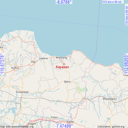
Kapasan GPS coordinates[2]
6° 46' 38.28" South, 111° 22' 44.04" East
| Map corner | latitude | longitude |
|---|---|---|
| Upper-left | -6.0786°, | 110.67578° |
| Center: | -6.7773°, | 111.3789° |
| Lower-right: | -7.47499°, | 112.08203° |
| Map W x H: | 155.3×155.3 km | = 96.5×96.5mi |
| max Lat: | 5.88969° ⇑22.9% North |
| Kapasan: | -6.7773° |
| min Lat: | ⇓77.1% South -10.934° |
| min Long | Kapasan | max Long |
| 95.1345° | 111.3789° | 140.9419° |
| W 39.4%⇐ | ⇒60.6% E |
Elevation
Elevation of Kapasan is 34 m = 112 ft, and this is 195.7 m = 642 ft below average elevation for this country.
| Max E: |
3185 m = 10449 ft | 68.9% |
| Avg. | 229.7 m = 754 ft | |
| Kapasan | 34 m = 112 ft | |
Min E: |
-1 m = -3 ft | 31.1% |
See also: Indonesia elevation on elevation.city.
Geographical zone
Kapasan is located in South Torrid zone (between Equator and Tropic of Capricorn). Distance of Equator is 753.6 km =468.3 mi to North.| Distance of | km | miles | from Kapasan |
|---|---|---|---|
| Equator | 753.6 | 468.3 | to North |
| Tropic Capricorn | 1852.4 | 1151 | to South |
| Antarctic Circle | 6647.6 | 4130.6 | to South |
| South Pole | 9253.5 | 5749.9 | to South |


Nearby cities:
15 places around Kapasan: (largest is in red/bold)
• Bogorame
2.7 km =1.7 mi,  297°
297°
• Kaliombo Wetan
2.1 km =1.3 mi,  240°
240°
• Karanggeneng
2 km =1.2 mi,  117°
117°
• Karangori Kidul
3.1 km =1.9 mi,  131°
131°
• Kebon
4.3 km =2.7 mi,  314°
314°
• Kemadu
4.4 km =2.7 mi,  175°
175°
• Kerep Wetan
2.7 km =1.7 mi,  28°
28°
• Krajan Landoh
1.8 km =1.1 mi,  330°
330°
• Mlawat
4.3 km =2.7 mi,  87°
87°
• Ngemplak Kidul
3.2 km =2 mi,  154°
154°
• Nrondo
4.3 km =2.7 mi,  343°
343°
• Pranti
3.2 km =2 mi, 304°
• Segoro
3.9 km =2.4 mi,  73°
73°
• Sulang Tengah
3.3 km =2.1 mi, 176°
• Tegalsari
3.6 km =2.2 mi, 178°
Sources, notices
• [Note1] Compared only with cities in Indonesia existing in our database
• [Src1] Map data: © OpenStreetMap contributors (CC-BY-SA)
• [Src2] Other city data from geonames.org with taken over terms of usage.
• [Src3] Geographical zone / Annual Mean Temperature by Robert A. Rohde @ Wikipedia
