Bradag geodata
Bradag (Central Java) is a seat of a fourth-order administrative division; located in Indonesia in Asia/Jakarta (GMT+7) time zone. In our database, there are 407 cities with bigger population. Compared to other cities in Indonesia, 66.8% of cities are located further ↓South; 61.8% of cities are located further →East and 52.7% of cities have higher elevation than Bradag. Note1


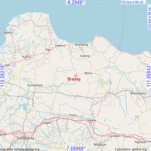
Bradag GPS coordinates[2]
6° 59' 35.88" South, 111° 17' 43.08" East
| Map corner | latitude | longitude |
|---|---|---|
| Upper-left | -6.2949°, | 110.59218° |
| Center: | -6.9933°, | 111.2953° |
| Lower-right: | -7.69066°, | 111.99843° |
| Map W x H: | 155.2×155.2 km | = 96.4×96.4mi |
| max Lat: | 5.88969° ⇑33.2% North |
| Bradag: | -6.9933° |
| min Lat: | ⇓66.8% South -10.934° |
| min Long | Bradag | max Long |
| 95.1345° | 111.2953° | 140.9419° |
| W 38.2%⇐ | ⇒61.8% E |
Elevation
Elevation of Bradag is 93 m = 305 ft, and this is 136.7 m = 448 ft below average elevation for this country.
| Max E: |
3185 m = 10449 ft | 52.7% |
| Avg. | 229.7 m = 754 ft | |
| Bradag | 93 m = 305 ft | |
Min E: |
-1 m = -3 ft | 47.3% |
See also: Indonesia elevation on elevation.city.
Geographical zone
Bradag is located in South Torrid zone (between Equator and Tropic of Capricorn). Distance of Equator is 777.6 km =483.2 mi to North.| Distance of | km | miles | from Bradag |
|---|---|---|---|
| Equator | 777.6 | 483.2 | to North |
| Tropic Capricorn | 1828.3 | 1136.1 | to South |
| Antarctic Circle | 6623.6 | 4115.7 | to South |
| South Pole | 9229.5 | 5734.9 | to South |


Nearby cities:
15 places around Bradag: (largest is in red/bold)
• Berbak
2.1 km =1.3 mi,  104°
104°
• Bocowanti
3.7 km =2.3 mi,  47°
47°
• Gondang
3.3 km =2.1 mi,  126°
126°
• Gotputuk
1.2 km =0.7 mi,  67°
67°
• Ketanggi
3.4 km =2.1 mi,  137°
137°
• Krocok
3.1 km =1.9 mi,  315°
315°
• Ngawen
2.2 km =1.4 mi,  119°
119°
• Ngrambitan
3.6 km =2.2 mi,  20°
20°
• Pecaren
1.6 km =1 mi,  160°
160°
• Pudak
3.4 km =2.1 mi,  80°
80°
• Punggursugih
2.8 km =1.7 mi, 142°
• Sambongrejo
2.9 km =1.8 mi,  55°
55°
• Suren
2.4 km =1.5 mi, 22°
• Tengger
0.9 km =0.6 mi, 15°
• Trembulrejo
3.2 km =2 mi, 156°
Sources, notices
• [Note1] Compared only with cities in Indonesia existing in our database
• [Src1] Map data: © OpenStreetMap contributors (CC-BY-SA)
• [Src2] Other city data from geonames.org with taken over terms of usage.
• [Src3] Geographical zone / Annual Mean Temperature by Robert A. Rohde @ Wikipedia
