Sidomulyo geodata
Sidomulyo (Central Java) is a seat of a fourth-order administrative division; located in Indonesia in Asia/Jakarta (GMT+7) time zone. In our database, there are 407 cities with bigger population. Compared to other cities in Indonesia, 76.1% of cities are located further ↓South; 58.8% of cities are located further →East and 63.2% of cities have higher elevation than Sidomulyo. Note1


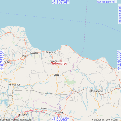
Sidomulyo GPS coordinates[2]
6° 48' 21.6" South, 111° 27' 37.8" East
| Map corner | latitude | longitude |
|---|---|---|
| Upper-left | -6.10734°, | 110.75738° |
| Center: | -6.806°, | 111.4605° |
| Lower-right: | -7.50365°, | 112.16363° |
| Map W x H: | 155.3×155.3 km | = 96.5×96.5mi |
| max Lat: | 5.88969° ⇑23.9% North |
| Sidomulyo: | -6.806° |
| min Lat: | ⇓76.1% South -10.934° |
| min Long | Sidomulyo | max Long |
| 95.1345° | 111.4605° | 140.9419° |
| W 41.2%⇐ | ⇒58.8% E |
Elevation
Elevation of Sidomulyo is 48 m = 157 ft, and this is 181.7 m = 596 ft below average elevation for this country.
| Max E: |
3185 m = 10449 ft | 63.2% |
| Avg. | 229.7 m = 754 ft | |
| Sidomulyo | 48 m = 157 ft | |
Min E: |
-1 m = -3 ft | 36.8% |
See also: Indonesia elevation on elevation.city.
Geographical zone
Sidomulyo is located in South Torrid zone (between Equator and Tropic of Capricorn). Distance of Equator is 756.8 km =470.3 mi to North.| Distance of | km | miles | from Sidomulyo |
|---|---|---|---|
| Equator | 756.8 | 470.3 | to North |
| Tropic Capricorn | 1849.2 | 1149 | to South |
| Antarctic Circle | 6644.4 | 4128.6 | to South |
| South Pole | 9250.3 | 5747.9 | to South |


Nearby cities:
15 places around Sidomulyo: (largest is in red/bold)
• Demaan
3.3 km =2.1 mi,  267°
267°
• Gambiran
3.9 km =2.4 mi,  78°
78°
• Gunem
0.6 km =0.4 mi,  101°
101°
• Karanganyar
3.8 km =2.4 mi,  289°
289°
• Kulutan
0.8 km =0.5 mi,  32°
32°
• Ngemplakrejo Lor
2 km =1.2 mi,  341°
341°
• Panohan
2.8 km =1.7 mi,  248°
248°
• Pragen Selatan
1.9 km =1.2 mi,  15°
15°
• Samaran
3.9 km =2.4 mi, 26°
• Sendangmulyo
1.8 km =1.1 mi,  239°
239°
• Sidorejo
4.5 km =2.8 mi, 19°
• Telgawah
1 km =0.6 mi,  220°
220°
• Tempaling
3.7 km =2.3 mi, 336°
• Tempel
2.7 km =1.7 mi,  329°
329°
• Trembes
3.3 km =2.1 mi, 97°
Sources, notices
• [Note1] Compared only with cities in Indonesia existing in our database
• [Src1] Map data: © OpenStreetMap contributors (CC-BY-SA)
• [Src2] Other city data from geonames.org with taken over terms of usage.
• [Src3] Geographical zone / Annual Mean Temperature by Robert A. Rohde @ Wikipedia
