Kubang geodata
Kubang (Central Java) is a seat of a fourth-order administrative division; located in Indonesia in Asia/Jakarta (GMT+7) time zone. In our database, there are 407 cities with bigger population. Compared to other cities in Indonesia, 52.1% of cities are located further ↓South; 69.6% of cities are located further →East and 70% of cities have lower elevation than Kubang. Note1


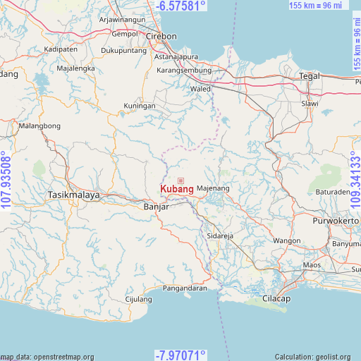
Kubang GPS coordinates[2]
7° 16' 25.68" South, 108° 38' 17.52" East
| Map corner | latitude | longitude |
|---|---|---|
| Upper-left | -6.57581°, | 107.93508° |
| Center: | -7.2738°, | 108.6382° |
| Lower-right: | -7.97071°, | 109.34133° |
| Map W x H: | 155.1×155.1 km | = 96.4×96.4mi |
| max Lat: | 5.88969° ⇑47.9% North |
| Kubang: | -7.2738° |
| min Lat: | ⇓52.1% South -10.934° |
| min Long | Kubang | max Long |
| 95.1345° | 108.6382° | 140.9419° |
| W 30.4%⇐ | ⇒69.6% E |
Elevation
Elevation of Kubang is 291 m = 955 ft, and this is 61.3 m = 201 ft above average elevation for this country.
| Max E: |
3185 m = 10449 ft | 30% |
| Kubang | 291 m 955 ft | |
| Avg. | 229.7 m = 754 ft | |
Min E: |
-1 m = -3 ft | 70% |
See also: Indonesia elevation on elevation.city.
Geographical zone
Kubang is located in South Torrid zone (between Equator and Tropic of Capricorn). Distance of Equator is 808.8 km =502.6 mi to North.| Distance of | km | miles | from Kubang |
|---|---|---|---|
| Equator | 808.8 | 502.6 | to North |
| Tropic Capricorn | 1797.1 | 1116.7 | to South |
| Antarctic Circle | 6592.4 | 4096.3 | to South |
| South Pole | 9198.3 | 5715.6 | to South |


Nearby cities:
15 places around Kubang: (largest is in red/bold)
• Batububut
7.9 km =4.9 mi,  244°
244°
• Cigalumpit
4.8 km =3 mi,  226°
226°
• Cigintung
7.9 km =4.9 mi,  55°
55°
• Cimalati
3.7 km =2.3 mi,  164°
164°
• Cirateun
4.9 km =3 mi,  266°
266°
• Ciwalen
3.4 km =2.1 mi,  259°
259°
• Datar
7.4 km =4.6 mi,  354°
354°
• Dayeuhluhur
3.4 km =2.1 mi,  297°
297°
• Karanganyar
6.4 km =4 mi,  173°
173°
• Majingklak
5.4 km =3.4 mi,  130°
130°
• Malabar
6.3 km =3.9 mi,  122°
122°
• Palugon
6.1 km =3.8 mi,  39°
39°
• Panulisan
7.5 km =4.7 mi, 239°
• Pasirmanggu
6.5 km =4 mi,  309°
309°
• Sogati
7.8 km =4.8 mi,  140°
140°
Sources, notices
• [Note1] Compared only with cities in Indonesia existing in our database
• [Src1] Map data: © OpenStreetMap contributors (CC-BY-SA)
• [Src2] Other city data from geonames.org with taken over terms of usage.
• [Src3] Geographical zone / Annual Mean Temperature by Robert A. Rohde @ Wikipedia
