Tanjungan geodata
Tanjungan (Central Java) is a seat of a fourth-order administrative division; located in Indonesia in Asia/Jakarta (GMT+7) time zone. In our database, there are 407 cities with bigger population. Compared to other cities in Indonesia, 80.3% of cities are located further ↓South; 55.6% of cities are located further →East and 98.5% of cities have higher elevation than Tanjungan. Note1


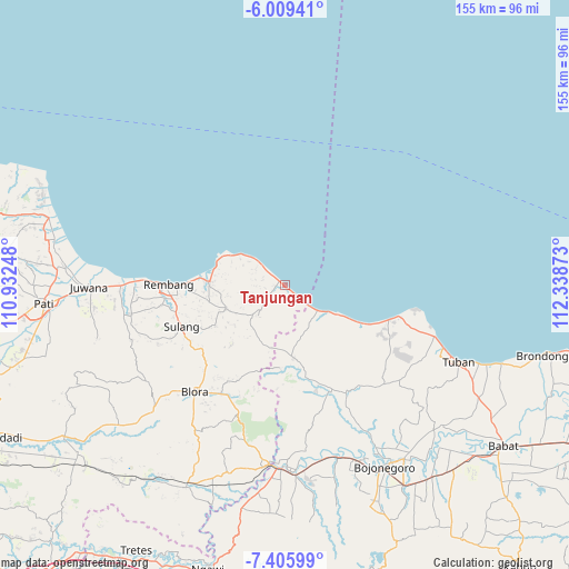
Tanjungan GPS coordinates[2]
6° 42' 29.52" South, 111° 38' 8.16" East
| Map corner | latitude | longitude |
|---|---|---|
| Upper-left | -6.00941°, | 110.93248° |
| Center: | -6.7082°, | 111.6356° |
| Lower-right: | -7.40599°, | 112.33873° |
| Map W x H: | 155.3×155.3 km | = 96.5×96.5mi |
| max Lat: | 5.88969° ⇑19.7% North |
| Tanjungan: | -6.7082° |
| min Lat: | ⇓80.3% South -10.934° |
| min Long | Tanjungan | max Long |
| 95.1345° | 111.6356° | 140.9419° |
| W 44.4%⇐ | ⇒55.6% E |
Elevation
Elevation of Tanjungan is 5 m = 16 ft, and this is 224.7 m = 737 ft below average elevation for this country.
| Max E: |
3185 m = 10449 ft | 98.5% |
| Avg. | 229.7 m = 754 ft | |
| Tanjungan | 5 m = 16 ft | |
Min E: |
-1 m = -3 ft | 1.5% |
See also: Indonesia elevation on elevation.city.
Geographical zone
Tanjungan is located in South Torrid zone (between Equator and Tropic of Capricorn). Distance of Equator is 745.9 km =463.5 mi to North.| Distance of | km | miles | from Tanjungan |
|---|---|---|---|
| Equator | 745.9 | 463.5 | to North |
| Tropic Capricorn | 1860 | 1155.8 | to South |
| Antarctic Circle | 6655.3 | 4135.4 | to South |
| South Pole | 9261.2 | 5754.6 | to South |


Nearby cities:
15 places around Tanjungan: (largest is in red/bold)
• Balongmulyo
4.9 km =3 mi,  309°
309°
• Balongteki
4.6 km =2.9 mi,  205°
205°
• Gonggang
3.1 km =1.9 mi,  190°
190°
• Kalipang
2.7 km =1.7 mi,  131°
131°
• Karanganyar
0.7 km =0.4 mi, 313°
• Karangharjo
1.5 km =0.9 mi, 310°
• Karanglincak
1.1 km =0.7 mi, 312°
• Kebloran
0.2 km =0.1 mi,  329°
329°
• Kendalagung
3.5 km =2.2 mi,  268°
268°
• Kragan
3.3 km =2.1 mi, 308°
• Krajandadapmulyo
4.5 km =2.8 mi,  181°
181°
• Mojokerto
4.1 km =2.5 mi,  226°
226°
• Ngilengan
1.6 km =1 mi, 190°
• Sarangmeduro
4.9 km =3 mi, 129°
• Sendangmulyo
4.8 km =3 mi, 132°
Sources, notices
• [Note1] Compared only with cities in Indonesia existing in our database
• [Src1] Map data: © OpenStreetMap contributors (CC-BY-SA)
• [Src2] Other city data from geonames.org with taken over terms of usage.
• [Src3] Geographical zone / Annual Mean Temperature by Robert A. Rohde @ Wikipedia
