Sendangharjo geodata
Sendangharjo (East Java) is a seat of a fourth-order administrative division; located in Indonesia in Asia/Jakarta (GMT+7) time zone. In our database, there are 407 cities with bigger population. Compared to other cities in Indonesia, 73.1% of cities are located further ↓South; 50.7% of cities are located further ←West and 92.1% of cities have higher elevation than Sendangharjo. Note1


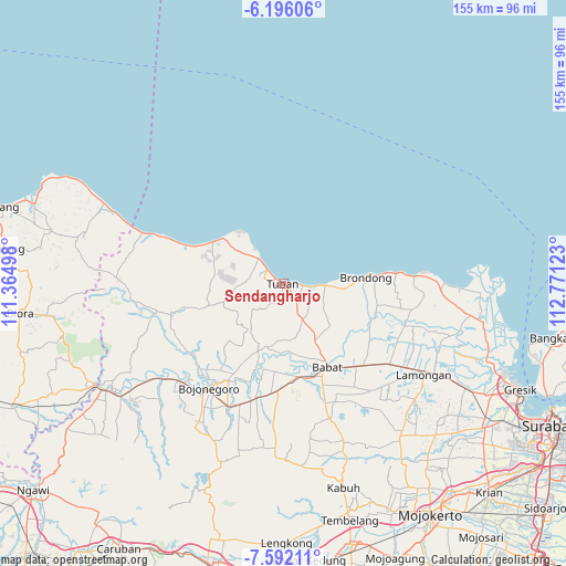
Sendangharjo GPS coordinates[2]
6° 53' 40.56" South, 112° 4' 5.16" East
| Map corner | latitude | longitude |
|---|---|---|
| Upper-left | -6.19606°, | 111.36498° |
| Center: | -6.8946°, | 112.0681° |
| Lower-right: | -7.59211°, | 112.77123° |
| Map W x H: | 155.2×155.2 km | = 96.4×96.4mi |
| max Lat: | 5.88969° ⇑26.9% North |
| Sendangharjo: | -6.8946° |
| min Lat: | ⇓73.1% South -10.934° |
| min Long | Sendangharjo | max Long |
| 95.1345° | 112.0681° | 140.9419° |
| W 50.7%⇐ | ⇒49.3% E |
Elevation
Elevation of Sendangharjo is 9 m = 30 ft, and this is 220.7 m = 724 ft below average elevation for this country.
| Max E: |
3185 m = 10449 ft | 92.1% |
| Avg. | 229.7 m = 754 ft | |
| Sendangharjo | 9 m = 30 ft | |
Min E: |
-1 m = -3 ft | 7.9% |
See also: Indonesia elevation on elevation.city.
Geographical zone
Sendangharjo is located in South Torrid zone (between Equator and Tropic of Capricorn). Distance of Equator is 766.6 km =476.3 mi to North.| Distance of | km | miles | from Sendangharjo |
|---|---|---|---|
| Equator | 766.6 | 476.3 | to North |
| Tropic Capricorn | 1839.3 | 1142.9 | to South |
| Antarctic Circle | 6634.6 | 4122.5 | to South |
| South Pole | 9240.5 | 5741.8 | to South |


Nearby cities:
15 places around Sendangharjo: (largest is in red/bold)
• Gedongombo
1.7 km =1.1 mi,  192°
192°
• Kajongan
0.9 km =0.6 mi,  279°
279°
• Karang
2.1 km =1.3 mi,  221°
221°
• Karangsari
2.3 km =1.4 mi,  296°
296°
• Kebonsari
1.2 km =0.7 mi,  200°
200°
• Krajan Bejagung
2.4 km =1.5 mi, 191°
• Kranggan
1.7 km =1.1 mi,  271°
271°
• Kuncen
0.5 km =0.3 mi,  145°
145°
• Kutorejo
0.6 km =0.4 mi, 274°
• Merik
2.2 km =1.4 mi,  248°
248°
• Paloh
1.6 km =1 mi,  290°
290°
• Panyuran
2.2 km =1.4 mi,  100°
100°
• Sidomukti
1.4 km =0.9 mi,  230°
230°
• Sukolilo
1 km =0.6 mi, 98°
• Tuban
0.5 km =0.3 mi, 226°
Sources, notices
• [Note1] Compared only with cities in Indonesia existing in our database
• [Src1] Map data: © OpenStreetMap contributors (CC-BY-SA)
• [Src2] Other city data from geonames.org with taken over terms of usage.
• [Src3] Geographical zone / Annual Mean Temperature by Robert A. Rohde @ Wikipedia
